PLEASE NOTE: Blog entrees are posted with latest entry at top. If you are new to my blog first let me thank you for your interest. Secondly, should you like to follow my journey from its’ inception, scroll down to my first entry.
Enjoy the journey _
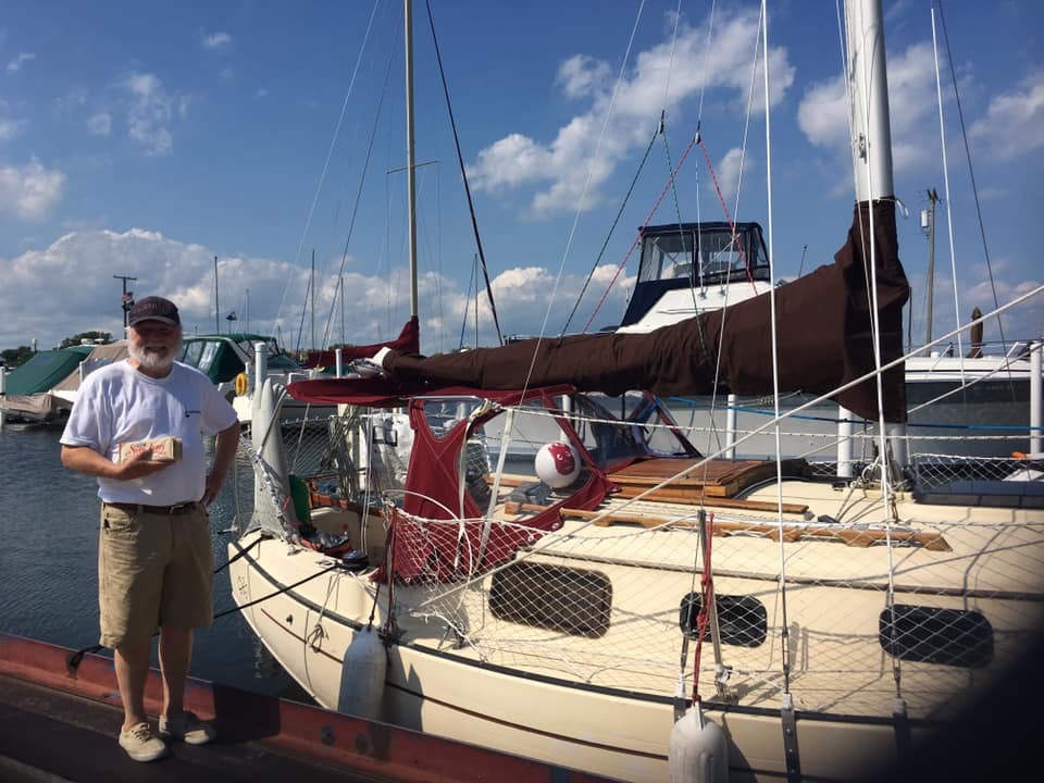
Amy greeted our (Never Too Late, Wilson and myself) arrival at JBM with my favourite chocolate bar. Journey Route Chronology: Lake St. Clair west down Detroit River; entered Lake Erie east along Ontario shoreline to Welland Canal; north down Welland Canal into Lake Ontario; east counterclockwise back to Welland Canal; south up Welland Canal into Lake Erie; west along south Lake Erie shoreline to Detroit River; up Detroit River into Lake St. Clair; north up St. Clair River; into Lake Huron north along Michigan shoreline; into Straits of Mackinaw west into Lake Michigan; south along Michigan coastline; west then north along Wisconsin shoreline of Lake Michigan; west through Sturgeon Channel into Green Bay; northward to Lake Michigan Upper Peninsula; east on Lake Michigan back into Straits of Mackinaw; north up St. Mary’s River; west and north into Lake Superior; east into St. Marys’ River; south into North Channel; east into Georgian Bay; south to and along Lake Hurons’ Ontario coastline; south St. Clair River into Lake St. Clair.
It is now November and my physical recovery is progressing as I continue to update my blog and investigate the possibility of a novel. Even though I fell short in circumnavigating all 5 Great Lakes in a single season, I feel a personal sense of accomplishment having singlehanded all five and circumnavigated four of the five Great Lakes in a sailing vessel (Pacific Seacraft Flicka) with a waterline under 20 feet (18′ 8″ to be exact). This shortfall has left me with somewhat of a bad taste and I am beginning to contemplate the feasibility undertaking a second attempt! Apparently my mental and emotional resolve has only strengthened!
Entry #107: N42.28.166, W 82.52.611
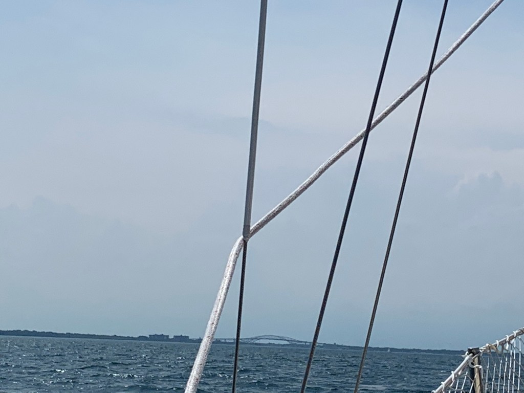
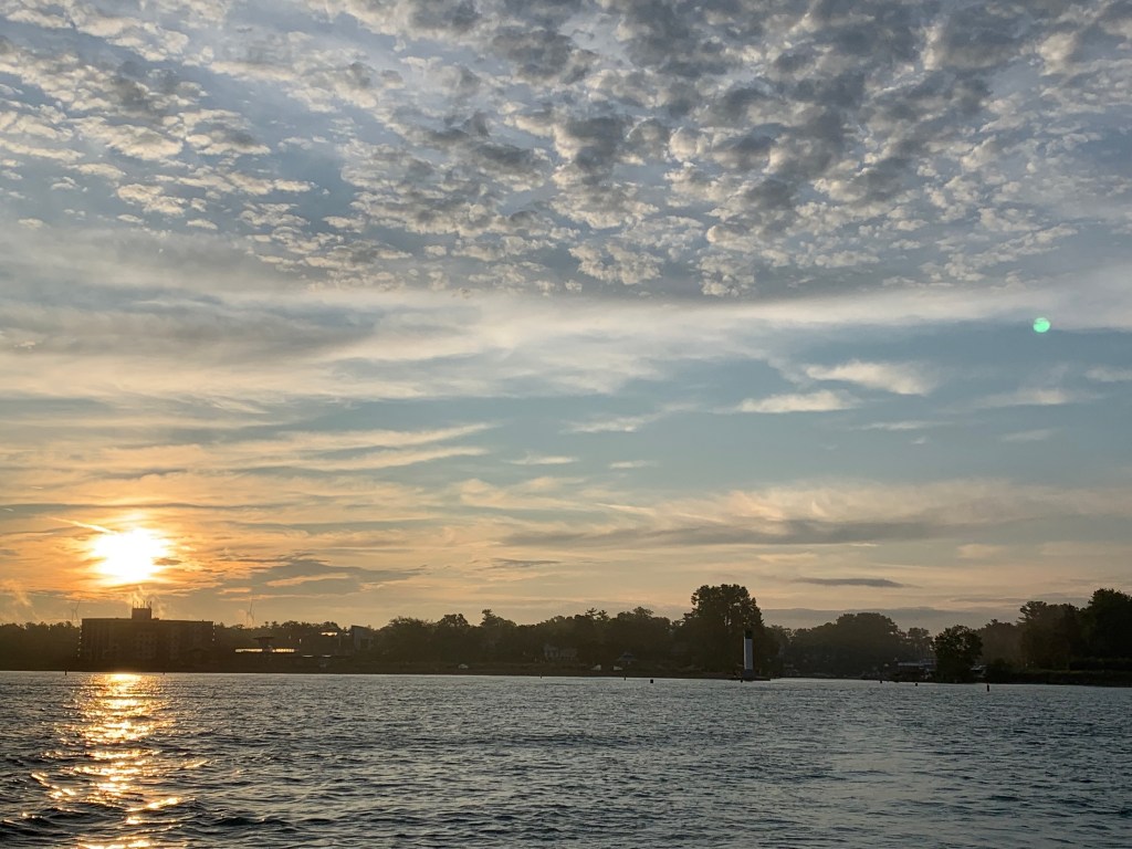
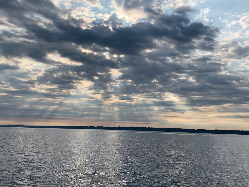
August 19th – Day 105: I awoke at dawn. It had stormed all night and the last storm clouds had passed overhead heading east. I started the engine and left the dock without delay. I will grab something to eat later. I was heading home. Once in the St. Clair River, I put up the jib sail, then the main sail and kept the engine running as I had over 45 miles left to go. With the helping current, I was making 7 ½ mph! I found myself giddy and relaxed. I found myself distracted and kept reminding myself to remain focused. After all that I have been through, it would be unforgivable to have something go wrong when I was this close. I hadn’t checked on the forecast – it didn’t matter – my mindset was to complete my journey today. No more delays. No more survival challenges. I need to take in this last leg enjoy what will likely be my last sail this season and navigate smartly. Except for keeping tabs on freighter traffic on my I-phone app I took in everything as though it was my last. I remembered this feeling following a final in college. It’s a good feeling.
The day turned out to be beautiful – sunshine, a comfortable breeze and warm weather! Its too bad my journey didn’t have more days like today. Oh well, the 90 plus days of weather (thunderstorms, tornados, high winds and seas), overnights and anchoring are behind me. I’m truly enjoying the moment.
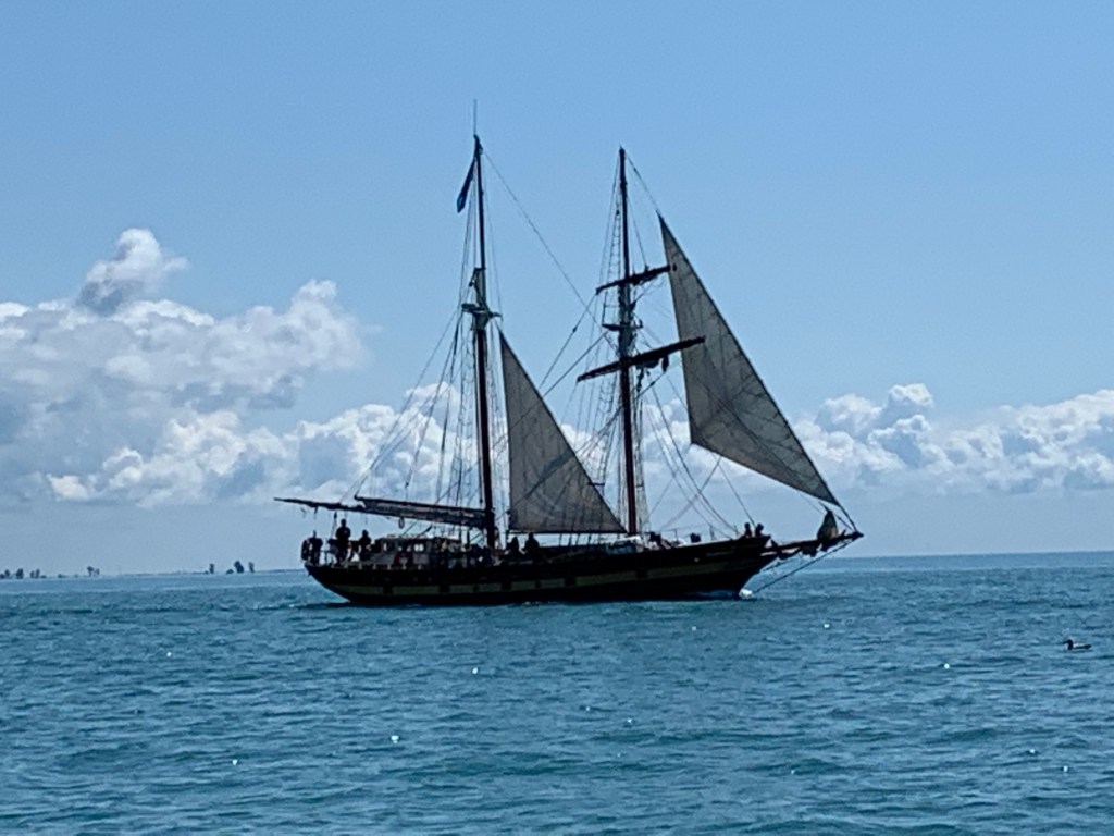
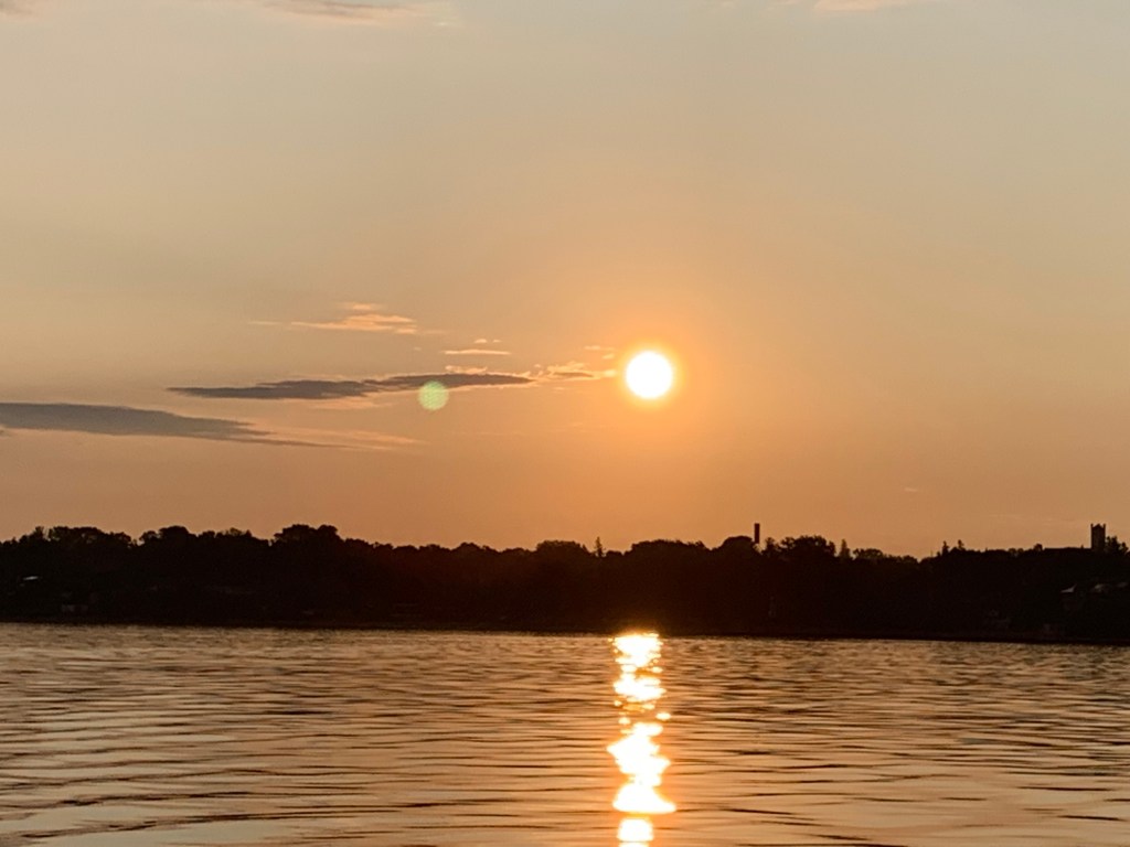
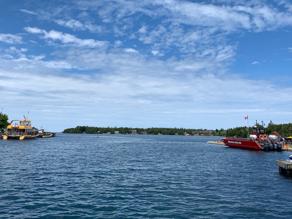
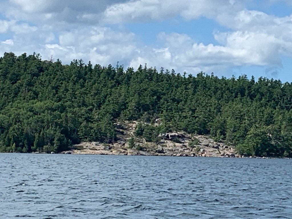
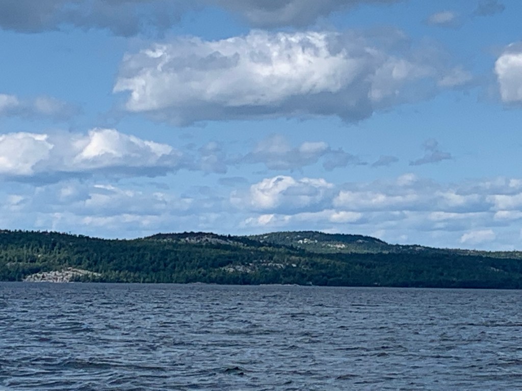
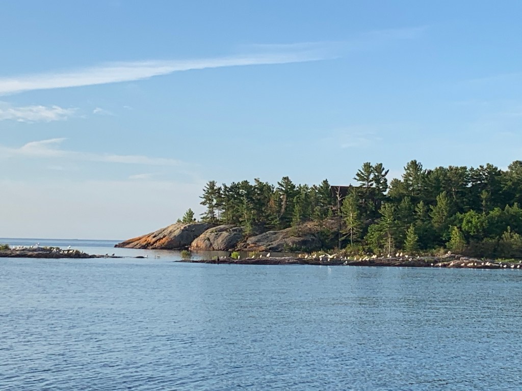
I entered Lake St. Clair as the winds were dying down. I soon found myself being overtaken by an 19th century schooner. I waved and thought that’s ok, I only have less than 10 miles to go.
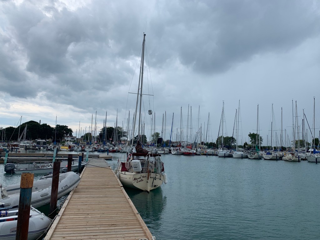
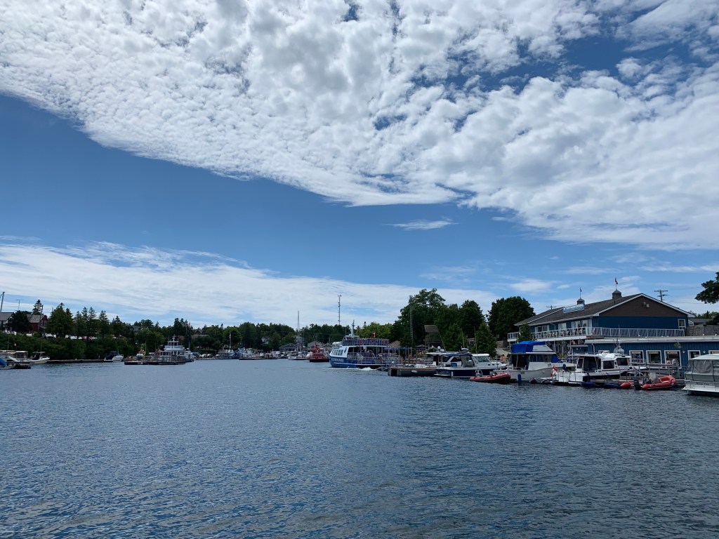
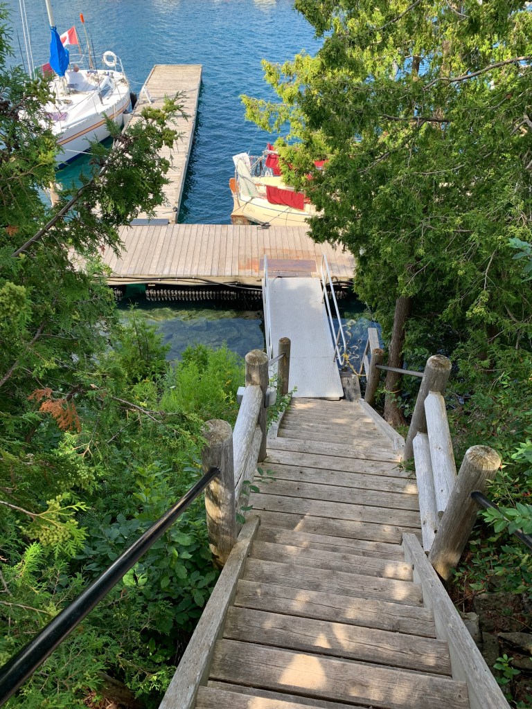
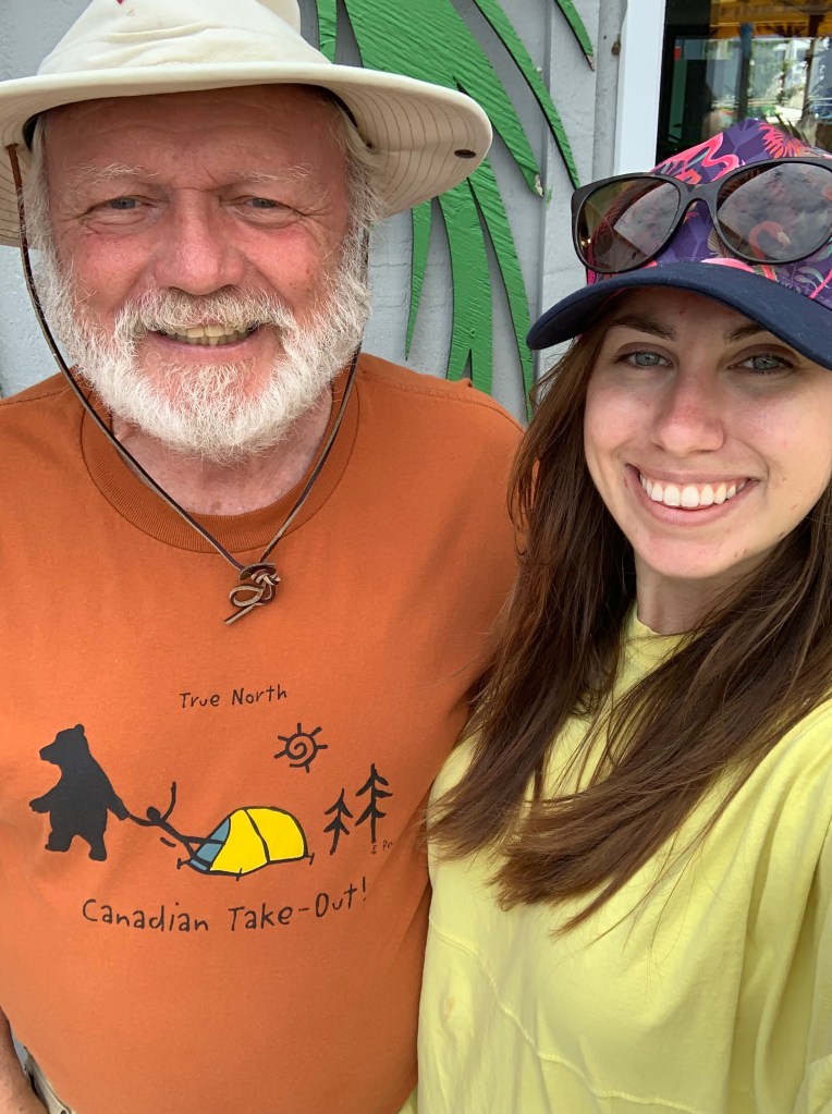
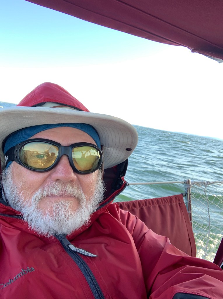
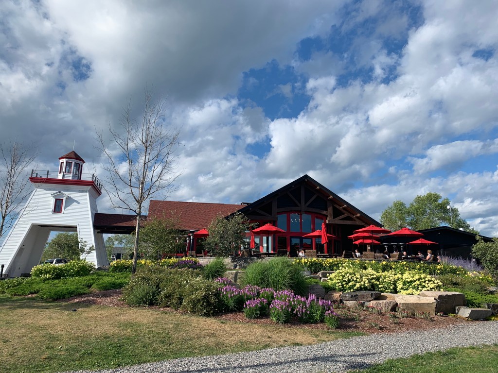
It was only 2:30 in the afternoon when I docked NTL. Amy (University of Michigan) greeted me and surprised me with a half a dozen symphony bars. Its a long story and I will detail it in my retrospective summary entry. (Note: I will be inputting my pictures with my last blog entry next).
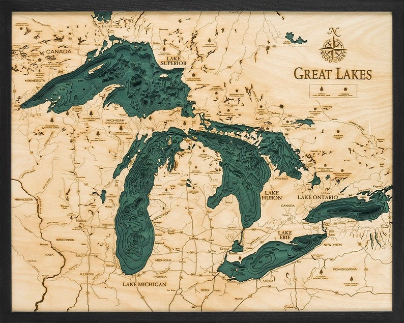
105 days, 3,100 nautical miles. Five Great Lakes sailed, four Great Lakes circumnavigated. I’m looking forward to sharing with you thoughts and insights and future plans. Thanks everyone.
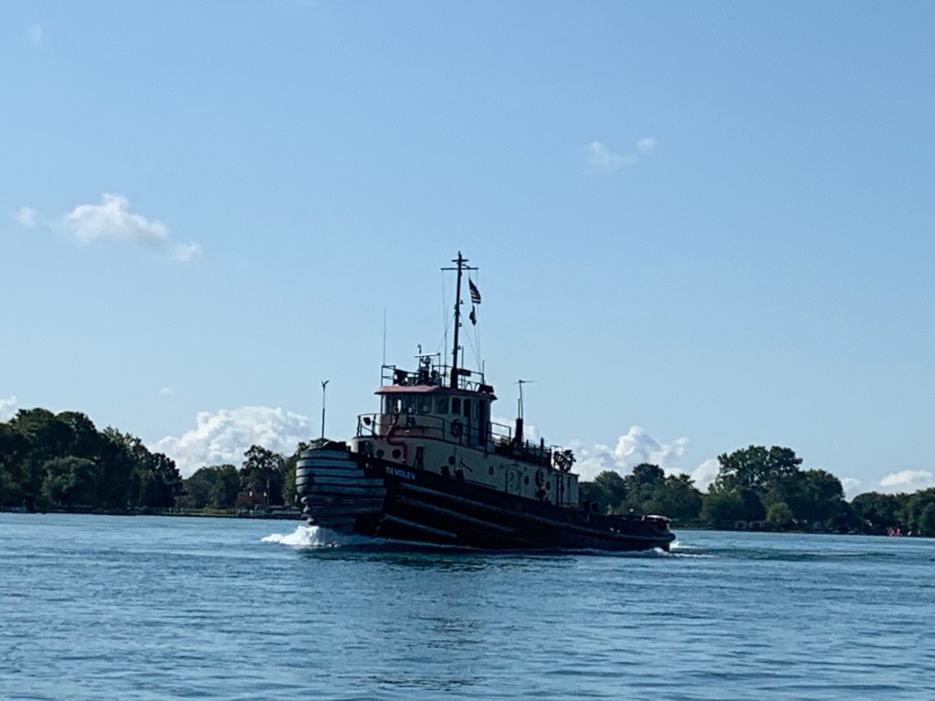
Tug going up the St. Clair River as Never Too Late heads towards Lake St. ClairPassed again!
Sunday, August 18th (Day 104) – I can’t help but feel that Mother Nature has had it out for me and she was trying to prevent me from completing my journey. She’s seeking to seize any opportunity should I make a mental mistake to send me to Davey Jones’ locker. Its not going to happen. I was more determined than tired. I feel more assured than my physical aches and pains. I concentrated on being alert and focused, more than I have been for a month. I can do this. No excuses. I will do this!
OK, Port Huron and the Blue Water Bridge is only 40 miles (as the crow flies) and my destination for tonight is St. Clair 50 miles. The latter is a bit optimistic but the closer I get to the St. Clair River, the stronger the current in my favour. With moderate to strong winds and clear skies my fingers are crossed. It was not to be….
I left before 7 am in the rain. The offshore wind was from the east but the 3 foot rollers were coming from the southwest. The forecast was for building winds shifting to the southwest in the late morning and another line of storms to hit around 5 pm.
While preparing NTL for the stronger winds and storm my auto-pilot began acting up and kept reverting to manual. Each time I had to go back into the cockpit and take over the helm re-set my course to 245 degrees. After numerous re-sets, I tried re-positioning the autopilot into a new slot hole. It worked. My auto-pilot functioned trouble free for the remainder of my trip.
In the building winds and cross beam seas, I reduced my jib size about 15% and let out my main about a foot. Between my sails and single piston diesel (running at 2,100 rpms) my GPS indicated NTL was moving above designed hull speed (5 ½ to 6 mph)! The current was definitely a helping factor.
At 8:30 am I passed the 3,000 mile mark of my journey. I smiled when I noticed a monarch butterfly landing on my bimini before flying off. (I had seen a monarch butterfly while sailing in each of the Great Lakes with the exception of Lake Erie.) Based on my current speed and heading I would make the Blue Water Bridge around 3 pm.
By mid-morning the overcast skies had lifted and though the wind and seas had continued to slowly build, I found my boat speed had progressively slowed to 4.9 mph. This has resulted to pushing back my arrival time to 5 pm. The winds were now 12-15 knots with 3-4 foot seas. And, they have shifted. Instead of sailing on a beam reach, I was now heading into the wind and seas – resulting in my lower speed. Further the latest weather forecast indicated an earlier arrival (5 pm) of severe thunderstorms (including small craft warnings). I have been in the basin of Lake Huron during a storm and I didn’t want a repeat experience. So I set a full jib and tightened my main before increasing my throttle to 2,700 rpms. My speed increased a full mile to 5.9 mph.
By 1 pm the wind had died down leaving my jib limp. And I was still some twenty-five miles from St. Clair Municipal Marina. I could already see clouds on the western horizon and given current conditions, it was unlikely I would beat the storms.
(While studying the horizon to the west, I noticed two large freighters anchored about a mile apart near the Michigan coastline. I assumed they were waiting for the severe storms to pass before entering the St. Clair River. Later I found out I had been mistaken.)
It was time to consider contingencies. I identified two marinas just northeast of the Blue Water Bridge. I re-set my chart plotter and found them to be only 11 miles away. Unfortunately my efforts to contact either marina to secure a guest slip failed. I decided to plot my course for the two marinas anyway as I really didn’t see any alternative. I raised my engine throttle to 3,000 rpms.
I kept missing several passing thunderstorms as I continued heading towards the mouth of the St. Clair River. (They seemed to follow up the St. Clair River and at the Blue Water Bridge each storm would either pass in front or behind me before going east into Ontario.) Fortunately, with each passing storm came fresh winds and together with the current on my stern, I had made great time. It was just 3:30 pm when I entered the tight entrance and small harbour of the two Sarnia marinas. Another thunderstorm was about to hit as I sought to dock NTL. Fortunately the storm slipped by me to the south and I decided to give up on docking and go for St. Clair.
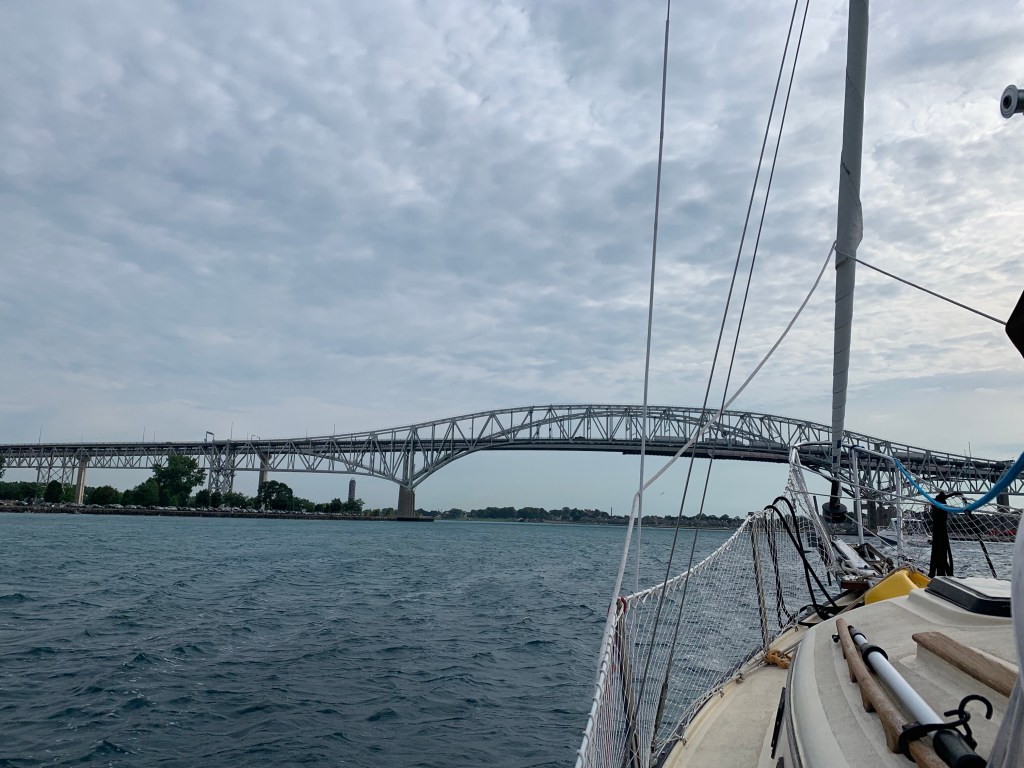
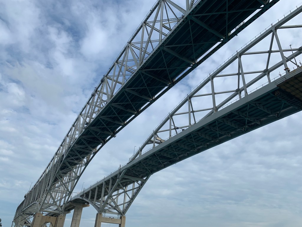
With a beaming smile, I was about to go under the Blue Water Bridge to complete my fourth Great Lake circumnavigation when I was stopped and confronted by another U.S. Customs Boarder Patrol Boat! I was prevented from passing under the Blue Water Bridge and needed to turn around as the St. Clair River was closed! HONEST! I couldn’t make this up. Apparently there was an unauthorized floating raft event down the river and St. Clair River was closed until 6:30! So that’s why the two freighters had anchored.
Ok Mother Nature. Your thunder storms hasn’t stopped me. And fetching the USCBP on me was unsuccessful? And the temporary shutdown of the St. Clair River will not deter me? I can wait. You are not going to stop me. Do you hear me Mother Nature! (To the readers of my blog, I apologize for the rant.)
I returned to the small harbour I had just left and tied up on a break wall to be protected from yet another passing thunderstorm. From here, I estimated it would take me about 2 hours to reach St. Clair. With the river opening at 6:30, I should have just enough time before darkness set in.
Suddenly two people walked over to my boat. ‘This dock belongs to the Sarnia Yacht Club. You are not allowed to tie up your boat and need to leave,’ said one individual. I responded that the river was closed, there are severe storms passing through and I’m seeking safe harbour until the river opens at 6:30 pm. ‘You can anchor the harbour’ responded one individual. I again responded, given the direction of the storms, I would be exposed anchored in the small harbour and in potential danger. No, after over 100 days I am tired and plan to safe harbour here protected by your berm. I will leave at 6:30 pm when the river opens. If that is unsatisfactory, please feel free to call the police or cost guard. The two individuals huddled and then replied, ‘OK, you can stay here but need to leave at 6:30 pm. The second person pointed to a small building and said, ‘You’re welcome to use our restroom’. I thanked them as they walked back. (I wondered, were they Mother Nature in disguise?) As I closed my eyes I felt ‘So close and yet so far’ before taking a snooze in the cockpit.
At 6:30 I promptly headed set out and followed a large cruiser under the Blue Water Bridge. Y E S! 104 days and 3034 nautical miles! Y E S!
Oh no. What are those blue and red flashing lights ahead? I line of boats – U.S.C.B.P., U.S.C.G., Sheriff and Police boats were all lined across the river each stopping boats from passing through? A U.S.C.G. approached me and announced that the river will be closed until 8:30 pm and asked where I was headed? I replied, “St. Clair Municipal Marina.” He offered that I could go into the calm waters of the Black River until river traffic is allowed. I took the coast guards advise and moored at Desmonds fuel dock. I was met by a young fellow whose first name was Carson. I told him I really didn’t need much fuel and related my story while he handed the fuel nozzle. The gallon of fuel was on the house.
It happened that the Boarder Patrol had also moored beside me. I walked over and asked if I could report my NEXUS number to them. They politely declined saying I needed to call in. After completing my NEXUS call-in I found Carson to ask where was a good hamburger place. I then walked into town and grabbed a bite to eat.
It was dark, raining and thundering when I returned to NTL. By now there were numerous other boats moored at the fuel dock – all, including myself – were given permission to safe harbour through the night. Thankful, I slept soundly that night.
If Carson reflects the level of hospitality of Desmond Marina, I need to consider keeping NTL here.
Blue Water Bridge Finally In SightSafe Harbouring Passing Thunderstorm & High WindsSt. Clair River Closed Turned Back Before Able To Complete Lake Huron Circumnavigation!Again Tie-Up Awaiting St. Clair River To OpenFinally, Crossing Under blue Water Bridge only to be Stopped By US C&BP. Sun rising in early morning. Scattered storm clouds heading north east. Encountered storms throughout the day.
Saturday, August 17th (Day 103) – The satellite weather forecast rain with possible thunderstorms in the morning, clearing in the afternoon. A series of more severe thunderstorms were projected to arrive around 10 pm in the Port Huron area. Throughout my journey, storms have been arriving ahead of forecasted times. With the exception of Grand Bend (only 22 nautical miles from my current position), my charts indicated no other potential safe harbours between Bayfield, Ontario and Port Huron, Michigan. The urgency to reach the Blue Water Bridge and complete my circumnavigation of Lake Huron overrode any consideration to remain in port for another day. I decided that I should at least make Grand Bend if the morning thunderstorms necessitated safe harbouring. Or if conditions warranted, I planned to head out into the lake, batten down and ride it out. In either case, I would be making progress.
I left my slip under overcast skies at 7 am and headed for St. Clair Municipal Marina some 65 miles away (as the crow flies). Never Too Late would need to muster its’ designed hull speed the entire way (5.6 mph) in order to arrive before the weather was forecast to arrive!
I found the winds coming offshore from the southeast at approximately 5 knots. However, seas were coming from the southwest at moderate at 2′ to 3′. By mid-morning the first storm hit with winds in my face at 10 knots. Seas had now built to 4-8′. Never Too Late was moving well below hull speed and sailing conditions required my attention.
By noon both the storms and periods of rain had given way to blue skies. The winds had been clocking around and were now coming from the same direction as the seas. After five hours, Never Too Late had made only 15 miles and my GPS was projecting a post midnight arrival time into St. Clair harbour. Additionally, the latest satellite showed the line of thunderstorms were now projected to arrive around 8 pm! Disappointed, I changed my course and called in to reserve a slip in Grand Bend, Ontario.
I arrived at Grand Bends’ municipal marina fuel dock shortly after 2 pm. Grand Bend is often referred to as Canada’s Fort Lauderdal and was packed with tourists, activity and noise. The scene reminded me of a beach scene in the movie ‘Jaws’ and could best be described as chaotic with people and power boats of all sizes coming and going in multiple directions. The ‘no wake’ waters were dangerously choppy and Skidoos seemed to be flying from every direction in the small river entrance. There was no harbour and very little manuevering room. I slowly made progress to the fuel dock and somehow managed to secure the bow of NTL to a corner of the pier without assistance. I was keeping my stern from hitting a steel beam when finally someone came running apologetically to help me secure the stern. It was crazy but I was relieved my boat was undamaged.
I went into the office registered and was hurriedly given a copy with my slip assignment next to a Carver Cruiser?! OK, but before I could get directions, the dock assistant ran out to assist another incoming boat. I quickly followed him out asking were the bathrooms, showers and laundry room were located. He pointed to the back of the building and focused on assisting the other docking boat. It was hot, everything looked hazy and I felt abandoned. I decided to hit the head (bathroom that is!) and investigate the showers and laundry.
Without a harbour, Grand Bends’ municipal marina slips followed both sides of the river bank. The winding river was not very wide. With no room for piers, boats were tied up along both sides of the river like cars parked on a street. The width of the river left barely room for two boats to pass each other let alone turn around! NTLs’ slip reservation was apparently located up the river “a ways” on the other side of the marina’s facilities! With no way to cross over, I sought permission to leave NTL tied at the fuel dock while I washed clothing and showered. I requested change from the office (again given no currency exchange) and gathered my dirty clothes, items to shower and a set of clean clothes. When I got to the laundry room and threw my dirty clothes into the wash I realized I had run out of laundry detergent! I washed my clothes without laundry detergent – yes a guy thing – before leaving to take a needed shower. I found the shower calming and refreshing. I returned to NTL, picked up a book and went to the laundry room to read while awaiting for the wash.
After 30 minutes or so, I thought ‘boy the wash was taking a long time’? I went to check on it when I realized that I had accidentally put my clothing in the dryer instead of the wash! Dam. My warm clothing smelled clean so I decided they had been dry cleaned. Besides I was tired, hungry and I still needed to parallel park NTL.
I found another boat in what I thought was my assigned slip. This was now ridiculous and I had no intention of going back to the mayhem and so I snugged NTL between a couple boats further down and went below to get ready for a meal. While considering what to eat, I couldn’t remember having paid for my slip! Hmm.
A few minutes later the same dock assistant was hailing me from a little dingy saying that I was in the wrong slip and needed to move. However, he confirmed that my assigned slip was being used by an unauthorized boat. He then offered to move boats to make room in my assigned slip. (I chucked to myself as I thought about how one goes about parking a vehicle in Mexico.) I wanted to see this as I extracted NTL from her slip and into the middle of the river. The dock assistant called in and apparently was directed not to move any of the boats. While still on the phone he asked me when I planned to leave in the morning. I responded saying that I had 40 miles to Port Huron and planned on leaving early. I ended up in a slip between two Hattaras behemoths.
I thanked him for his assistance and before leaving he asked me ‘if I had paid for my slip’.? We both laughed as I realized that indeed I hadn’t paid. He requested I pay him the $40 (Can) directly. Not only was that a bit steep, I only had a US $50 bill and was not about to give that amount w/o a favourable exchange. I got on his dingy back to the office and used my charge card.
It was sunny and hot. The storm and rain forecasted for the evening never came. It was a long day and I was tired, hot and annoyed. I decided to walk into town and enjoy a good meal with air conditioning . After dinner I originally planned to see the beach but instead gingerly walked back feeling as though I had more than one Stella beer. I got back to NTL before 8 pm and immediately crashed. I will not be returning to this marina.
Point of clarification: You may have noted my use of different terms when referencing distances. With ‘as the crow flies’, I am referring to a straight line or rhumline distance between points A and B; and, with ‘nautical miles’ I am referring to actual distances travelled. As an example, the ‘as the crow flies’ (or rhumline) distance from Bayfield to Grand Bend is 18 miles. But 22 nautical miles was required to reach my destination. The rhumline did not contemplate additional distances required when following a channel or avoiding shoals or islands or peninsulas, let alone additional distances due to tacking.
Heading for my slip in Grand Bend. Grand Bend marine traffic
Friday, August 16th (Day 102)– It was barely light out, overcast and drizzling when I left my slip heading for Bayfield. Given early morning winds (4 knots) my GPS was indicating a 10 pm arrival time! I decided to power sail and ran the throttle at 2,100 rpms. The south south west winds picked up slightly and by 9 am my projected arrival time had shortened to 7 pm! The winds remained steady into the afternoon before dropping again down to 4-5 knots under clearing skies. I decided to increase my throttle to 2,400 rpms.
With conditions moderate throughout the day, I was able to plan my arrival to Jefferson Beach Marina. I called Jefferson Beach Marina and notified them of my arrival projected for late Sunday or Monday. I would go straight to the hoist and scheduled NTL to be hoisted on Tuesday for winter storage. The thought of going for an afternoon sail in the fall was not being considered.
I arrived in Bayfield a little after 5 pm, fueled and tied up in my assigned slip. I had covered 48 nautical miles in a little over 10 hours. It was a good day.
Thursday, August 15th (Day 101) – Forecast calls for rain and thunderstorms all day. However, my feeling of urgency to complete my journey and to get home was strong. I decided to head out for Kincardine (only 22 miles as the crow flies).
It was still chilly following a warm breakfast and I was glad I had my fleece on. I maintained shore power in order to keep the cabin heated as I prepared to embark.
Even though it was only mid-August, I needed to take into consideration the fact that the hours of daylight was decreasing. Though I had no issue sailing in darkness, I began to work my Lake Huron itineraries so that I would make anchor or port before sunset to avoid coastline shoals and rocks.
It was raining when I got underway under power. The winds were light and my sails limp most of the day. It rained all day but at least I did not encounter any thunderstorms as had been originally forecasted. I reached the municipality of Kincardine mid-afternoon after covering 27 nautical miles.
I enjoyed a hot shower, ate canned chicken and fell asleep at dusk to the sound of bagpipes. Only a little over 100 miles to the Blue Water Bridge!
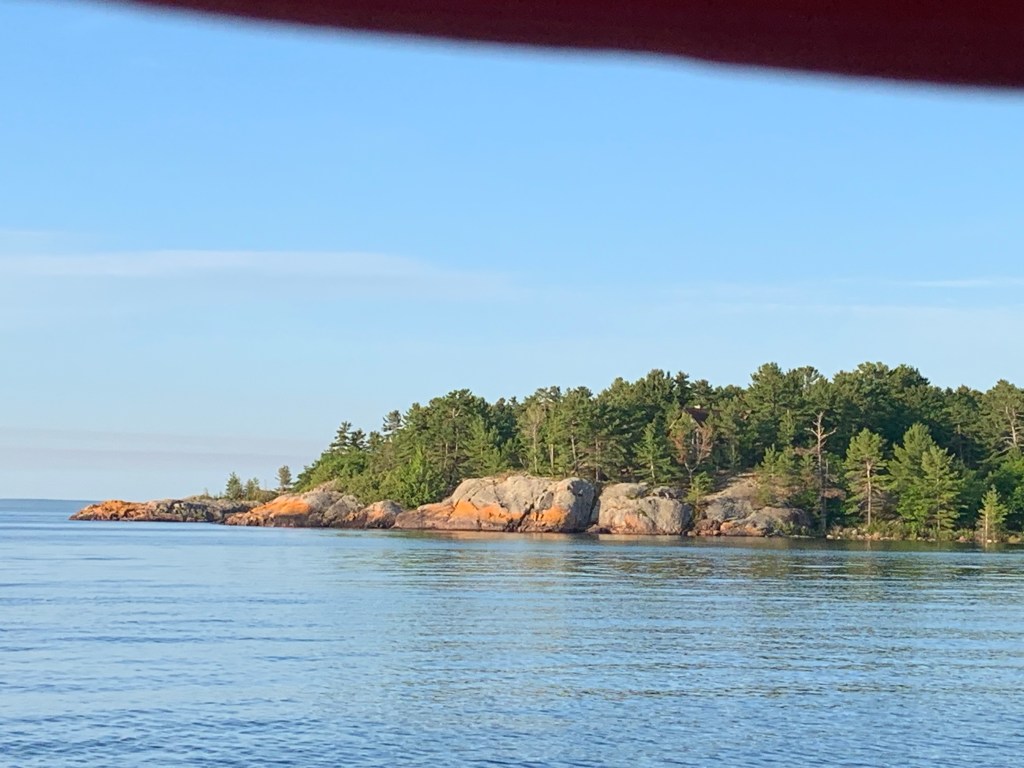
View from the shoreline prior to departure.Looking back as I head down Ontarios’ Lake Huron coastline
One of many reasons I seek _ ‘My experiences – those sought and those I realize – serve as foundation of who I have become. My experiences give me insight and perspective, molding my view on life and my values. But most of all, the insights and knowledge I have gained through my experiences has strengthened my inner self, my self-esteem, my humility, my love of nature and my empathy for humanity.’
Wednesday, August 14th (Day 100) – Though it was quieter, I didn’t get a very good nights sleep. I have come to understand what to expect and the combination of storm forecasts, the distance I needed to travel to reach Port Elgin (57 nautical miles), shoals and rocks along the Ontario coastline and my recent experience with fog gave me concern. But I found myself wanting to complete my journey and the closer I was getting to the Blue Water Bridge (160 nautical miles), the easier it was becoming to lift anchor or leave dock.
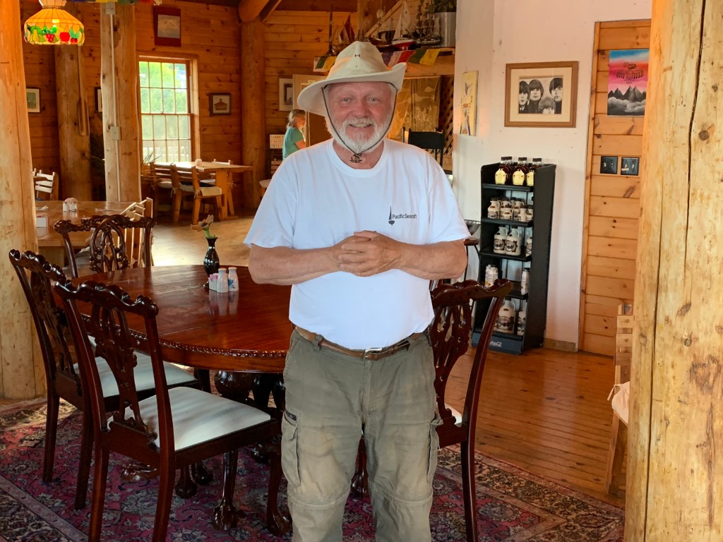
Paul Lockwood saw me off. He was a retired rigger and he and his wife were sailing in a 42 footer that had seen better days. His vessel originally was designed to seriously race. But he made modifications for cruising to accommodate his wife. Apparently his children were quite successful and were helping them out. I got the sad impression that he was taking in every moment of their trip as though it was their last hurrah sailing. Paul had left an imprint on me.
The seas were a bit ‘bumpy’ and on my beam when I set out to round the tip of the Bruce Peninsula. Once I rounded Russell Island and changed heading I found both seas and wind on my back. The rolling seas became bigger than the winds would suggest. I soon noticed storm clouds developing in the southwest on the horizon in front of me. I had already made the decision to sail through the isolated thunderstorms and commenced to head out into open water. I wanted to sail in deeper water and away from the coastline as a safeguard against shoals and rocks while in storm conditions.
During the course of the day, the winds peaked at around 13 knots while averaging around 7-8 knots for most of the day. before dying down in the early evening. I finally reached the narrow entrance into Port Elgin after having maneuvered between the rocks and shallows.
I had hailed the municipal marina notifying the harbour master that I would be arriving late. I received instructions and found myself tying up on the pier in front of a small restaurant. It had been a long day sailing (14 ½ hrs. and 64 nautical miles) but fortunately uneventful. Though there were good winds and blue skies between the isolated thunderstorms, I hadn’t encountered a single sailing vessel that day. The pier served as a popular jogging and strolling facility and I encountered numerous curious people. One individual was clearly intrigued with my journey and only after I politely expressed my desire to take a shower did he finally ask what time I had planned to depart the next morning did he depart. (He did see me off in the morning.).
After taking a shower, I returned to the NTL, ate a sardine sandwich. I covered my portals (windows) blocking the onlookers and immediately fell asleep.
The next morning I ate a good breakfast before setting off for Kincardine.
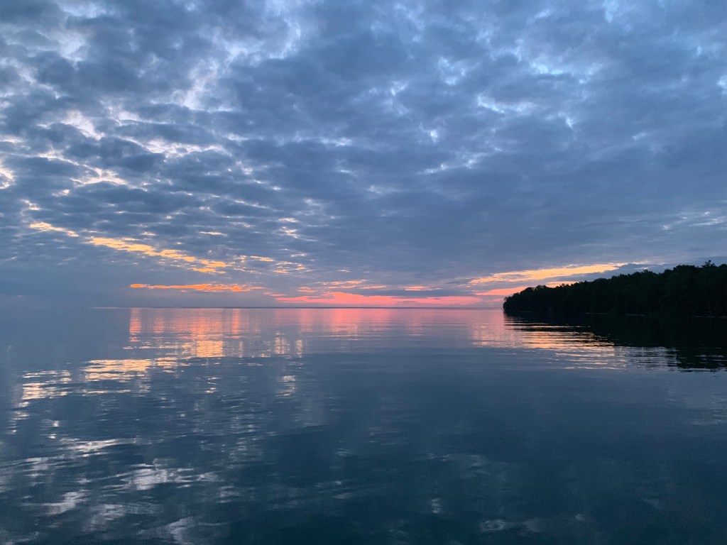
Sunset as I near port.Hit another storm – I’m wearing out!Safely docked in Port Elgin
Monday, August 12th & Tuesday, August 13th (Days 98 & 99) – The anchors held and NTL made it through the night of winds and rain without incident. I woke up early in calm waters and under overcast skies to a red sunrise. The forecast was not promising so I hurriedly got ready to get under way. Even though it was only the second week in August, it was cool and I could see my breath. I put on long sleeves, long pants, wool socks and hat. I had been experiencing occasional ignition delays when attempting starting up the engine recently but she started up right away as I got underway. The other anchored sailboat was not far behind and had soon motored passed me by heading south as well. Apparently we both had the same sense of urgency with the coming storms as we lifted anchor before 6 am.
I put up my sails in 5 to 7 knot winds that were coming from the southwest. There was still no internet two hours out and I was unable to get an updated weather forecast. I kept an eye on the growing and menacing clouds north and to the west.
Five hours out the winds continued to steadily build while shifting to the northwest. I became seriously concerned with the development of a thick fog in front of me. And of course, it had begun to rain from the dark clouds coming from the rear. Not good. Tobomory was surrounded with rocky islands and I was only about 10 miles out! Adding to my concerns was the fact that Tobomory was the port for the Chi-Cheemaun Ferry. Without access to the internet or phone service, I had no idea regarding the car ferry’s schedule or its’ route! I took out my fog horn in readiness and continued forward keeping a close eye on my GPS chart plotter display.
About five miles from my destination, I began to see the silhouette of an island to my port. I confirmed its presence on my GPS display. Minutes later, the fog began to lift. Whew! Less than 10 minutes later I was sailing under blue skies and sunshine with Tobermory’ harbour directly in front of me. I hailed the municipal marina for directions as I entered the harbour entrance.
After tying up NTL in her assigned slip, I showered and explored the hopping port town. This was not the remote Tobermory I had visited as a boy. Todays’ Tobermory was packed with tourists speaking French, Japanese, German, Italian. The small harbour was filled with glass bottom tour boats, snorkelling, scuba diving and guided island sightseeing vessels. Boats displaying para sailing, tubing and skiing charters. Kayak and water boarding rentals. And signs giving directions to numerous hiking trails. And of course there was the Chi-Cheemaun Ferry capable of transporting 150 vehicles and their occupants to Manatoulin Island over dinner! All level of activity and tourist atmosphere was quite unexpected and a far cry from my previous ‘far from civilization” stops.
I had a meal at Coconut Joe’s Harbour Bar & Grill then retired for the evening.
My slip was located right in the heart of town and I was awakened several times before things finally quieted down around midnight. The next morning I got up to 30+ knot winds from the northeast with rain and possible storms forecast for the late afternoon and evening. Not unlike the US Alpena side of Lake Huron, the shoreline was inundated with shoals and rocks. Port Elgin was the closest safe harbour and it was 55 miles away. I had no intention of sailing in storms.
I decided to wait for better weather and stay another day. The next morning I splurged and enjoyed an omelette breakfast with toast and coffee. The rest of the day I spent relaxing, talking with several sailors and purchasing gifts for my grandchildren. Wednesdays’ weather forecast was much more promising. With assistance, I was able to extract myself NTL from her slip and re-located further away from the towns’ centre. That night was much quieter and I had a good nights’ sleep.
I enjoyed my two days in Tobermory. It felt more like a mini-vacation instead of a sailing journey. It was a welcome change. And now, I’m homeward bound. I need to be careful and hold back my excitement as my journey is not complete and there remains the unknown and challenges to meet.
Entering Tobermory HarbourTobermory MarinaNever Too Late amongst the big boys. It took four people to assist in extracting her to a quieter dock!Never Too Late quietly docked in TobermoryReturning to Never Too Late following gift shopping for grandchildrenNever Too Late docked in across centre of TobermoryCoconut Joes’Oh The Burden of An Old Man!
Sunday, August 11th (Day 97) – I estimated Killarney to be over 300 nautical miles from Lake St. Clair. Storms and heavy winds from the south west were forecast for the late afternoon, through the night and into tomorrow. I didn’t want to be exposed in open waters finding no evidence of potential no safe harbour(s) along the Georgian Bay eastern coastline. These factors together served to make the decision to take the most direct route south towards Tobermory.
Tobermory was located at the tip of the Bruce Peninsula some fifty-five miles to the southeast of Killarney. Given light winds projected to come from the west and south for most of the day, it was unlikely that I would make Tobermory today. Additionally, the waters around Tobermory were known to be dangerous often with fog with winds clocking at over 50 knots during heavy storms. I had had enough in those conditions and was not willing to take on the risk and challenge.
I found James Bay on Manitloulin Island as the only potential safe harbour between Killarney and Tobermory. It was located only 25 miles south of Killarney again offering good anchorage and potentially adequate protection. However, should the forecast prove to be inaccurate James Bay would offer little to no protection with winds coming from the north or east! With my only other option to stay and wait for better weather, I decided to leave early. And my strategy would leave me with a shorter distance with a potential reasonable arrival time in Tobermory the following day.
I reached James Bay around 1 pm and initially contemplated going on to Tobermory. I re-checked the weather forecast, assessed the conditions and decided to play it safe. I anchored as close to the southwest corner of the bay around 2 pm. The winds from the west began to build in the late afternoon to over 20 knots. I decided to drop a second anchor as the winds shift to the south as a second sailboat arrived anchoring just west of NTL. It was re-assuring to me as I must have made the right decision and had selected a good spot for anchoring.
I found there to be no internet or phone service so I began to read. I fell asleep reading as I could hear a wolve howling into the night.
Never Too Late overnight anchor seeking protection from storms forecasted.Never Too Late along with another boat lifting anchor heading south in the early morning ahead of another storm. Sunrise peeking through coming storm. Second boat heading south towards Tobermory.The calm before the storm.No words.
Saturday, August 10th (Day 95) – Prior to Washington Island (Lake Michigan), I couldn’t wait to embark and meet the sailing challenges and adventures of the day. Sailing for days at a time and through the night(s) or anchoring days were common and easily undertaken. But the frequency and severity of weather had resulted in a number of challenges to overcome over the course of two months and it had taken a toll – physically and mentally. Since Washington Island (Lake Michigan) leaving the safety and comfort of each marina had become a mental challenge in and of itself. Further, my stamina – again both physically and mentally – had deteriorated and I found myself anxiously looking forward to docking after only a day or at most two of sailing. I am definitely feeling my age (70).
For the first time in a while my spirits were a bit lifted. I was beginning to see the light at the end of the tunnel – Blue Water Bridge, Port Huron. With fair winds and seas and a good angel over my shoulder, I would be leaving the North Channel and entering Georgian Bay today.
I left the protection of Gore Bay refreshed and eagerly headed northeast. I had been averaging a little over 3 mph over the course of my journey and todays’ destination (Killarney) was 56 miles away! I hoped the forecast of fair winds coming from the west at 12 to 18 knots would hold true. With the winds on my back and following seas, I should be able to achieve NTLs’ hull speed (5.6 mph) and arrive just before dusk. If not, I should be able to find good anchorage along my projected route. It will be a long day in any case but I felt I would be up to it.
In addition to needing to nearly double my average daily distance, the route to Killarney would require focus and good decision making as there were many boulders and rocky shoals to contend along the way. Todays’ trip would not be a walk in the park.
I found the winds and seas true to the forecast on my way to Little Current. (Will wonders never cease!). I was consistently at or over 5 knots (or 5 3/4 mph). With winds consistent, on my back and following seas it was a comfortable sail. This allowed me to focus on depths, shoals, isolated boulders and to make decisions on the best (safest) courses to take around numerous islands.
The scenery was beautiful and I wished I had more time to visit and take in the magnificent landscapes. In a little over five hours (a little past noon) I had reached the community of Little Current. I patiently held NTL in position while waiting for the swing bridge to open on the hour.
As the bridge swung open, I was suddenly swamped by what must have been a 70+ foot cruiser overtaking me to be first through and into Georgian Bay. It turned out to be a precursor as I experienced two additional instances on my way to Killarney.
As I power sailed through and into Georgian Bay I was faced with orchestrating through a spattering of islands and shoals. The winds were picking up and I was flying at nearly 6 knots (7 mph) in relatively calm (island protected) waters. For the next five hours while continuing to head east north east, I found myself maneuvering NTL through channels and in and around a number of islands. I chose to head south of Garden Island and north of Strawberry Island. I then rounded the south end of Partridge Island (avoiding several boulders) and once cleared, immediately headed north following the west coastline of Badgely Island. I finally entered Powderhouse Bay and sailed past George Island, lowered my sails and motored east through a tight channel into Killarney. I hailed the Killarney Mountain Lodge and was directed to dock next to a seaplane! It was a little past 6 pm and I had sailed 56 miles in just over 11 hours! My back was aching but what a great day of sailing.
I had travelled with my parents to Killarney once before as a young child. I could only call how far away by car it was from Toronto and how deep in the woods we were while visiting a family friend. Killarney has a current population of under 400. It is located at the base of beautiful landscapes and multiple rivers and streams on the northern shores of Georgian Bay.
That evening I went into the lodge for a meal. I ordered a hamburger, a side dish of poutine and a Stella. I enjoyed the meal more than the $59 bill! And US currency exchange was dollar for dollar!
I was tired and didn’t have the energy to check out the area. After completing my meal I returned to NTL, checked out the forecast and studied Georgian Bay charts to strategize tomorrows sailing route before retiring.
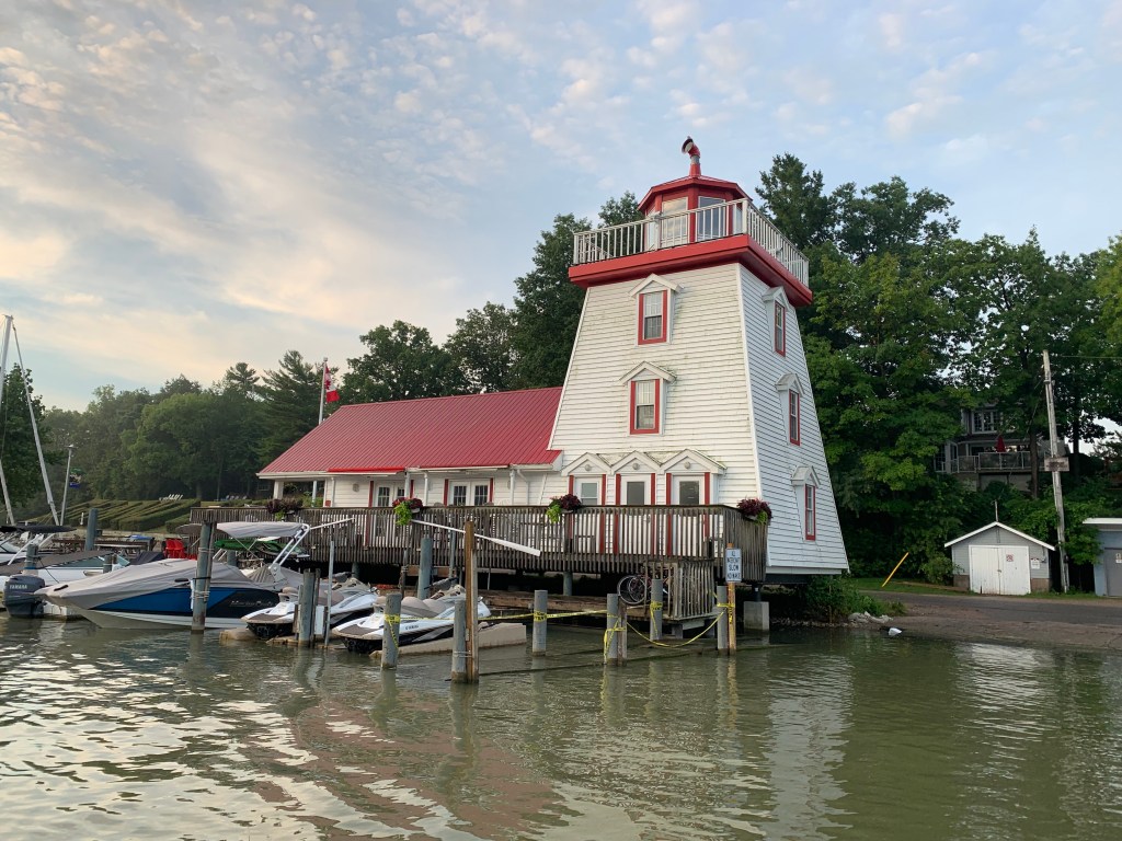
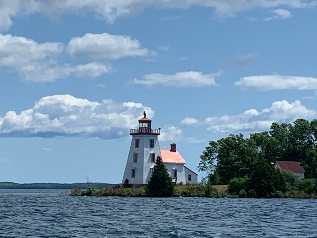
North Channel in August on my way to Little Current and KillarneyDid I take a wrong turn?Great sailing, beautiful scenery.Entering Little CurrentAwaiting Little Currents’ swing bridge to open.The arrogance and inconsideration of some of these mega yachts!Marking another beautiful lighthouse on my way to Killarney.First signs of KillarneyNever Too Late docked in Killarney next to a sea plane after a long day of great sailing.Killarney Lodge – $59 hamburger w/a beer!Leaving Killarney in the early morning on my way into Georgian BayAnother lodge in Killarney.Killarney cottage facing north eastern Georgian Bay.Slow progress in light winds. Seeking safe harbour anchorage for the night in James Bay on my way to Tobermory.
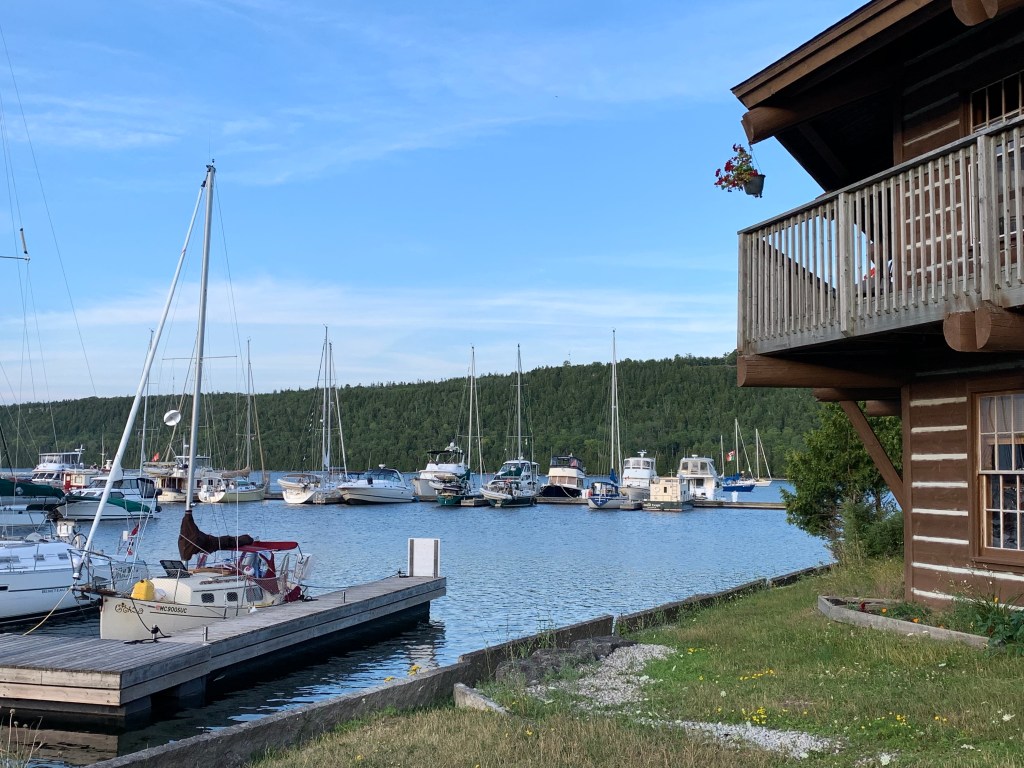
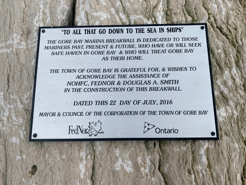
Wednesday, August 7th & Thursday, August 8th & Friday, August 9th (Days 93, 94 & 95) – I awoke to partly sunny skies and moderate winds from the west. While having breakfast comprising of cold oatmeal. dried blue berries and (2) tangerines, I checked the weather on my I-phone app. The forecast called for more thunderstorms from the west predicted to hit in the early evening. Given my experiences with weather forecasts, I made haste and lifted anchor setting out for Gore Bay about 32 miles to the east. Like Vidal Bay, Gore Bay would offer good protection but unlike Vidal Bay, there would be a small town with a marina. I hadn’t showered in several days and looked forward to the comforts of a slip with power for coffee and warm food.
As I sailed east following the Manitoulin Island northern coastline, I marvelled at the tranquility and scenery. I’ve always been fond of nature and the beauty of natural habitats. When sailing the North Channel, I was very focused on my water depth and potential granite rocks just below the water surface. Numerous guides recommend having a person at the bow of the boat to keep an eye on uncharted rocks – difficult to do when sailing singlehanded. I made a point of sailing in the deepest waters while avoiding taking a course over shallower water depth. As I progressed further east I began to notice limestone cliffs along the shoreline. This part of Manitoulin Island serves as the northern portion of the Niagara escarpment.
In the early afternoon I needed to adjust my heading to better handle the growing swells. Eventually I had to adjust my helm to better manage the overtaking swell. I made good time and arrived in my slip in a little over 7 hours covering 32 nautical miles.
After showering and sponge drying my tender skin, I walked into the small town and enjoyed a warm poutine meal and two cokes. The town of Gore Bay (population under 900) was one of two Manitoulin communities with a small airport for people travelling further north to fish and hunt or charter a boat. It also served as the government centre for the island. After my meal, I found a nice little grocery store and purchased two bananas, prindles and a dark chocolate bar. Yummy.
I returned to NTL in the early evening, ate a piece of chocolate and listened to ‘Give Me One Moment In Time’ by Nossa Vitrola on my I-phone before turning in.
I don’t know were the time flew, but before I knew it I had spent three nights in my slip. I was prepared to embark Thursday but the winds were howling that night and all day as evidenced by numerous vessels (35′ – 45′) had come in seeking safe harbour. I didn’t mind, for whatever reason I found my stay in Gore Bay very relaxing and comforting. I was still aching but I felt a little better. And, I had access to food and supplies, a shower, a laundromat, power, warm food and friendly people. What more could I ask for. Except for not having access to an internet. On day two, I had a unique dinner at a restaurant that looked from the outside like a gun tower. The restaurant was owned by a Buddhist! And my meal was delicious. On the third day (Friday) I went to an art fair at a park next to the marina. I ended up purchasing a handmade wooden jewelry box designed to look like a sailboat. A gift for my six week old granddaughter Mallory. I was looking forward to going to Dallas and seeing her.
OK, all good thing must come to an end and after checking the weather forecast, I prepared to set off for Killarney first thing in the morning. Given its distance (56 nautical miles), it will be a long day.
Sailing vessel leaving Gore Bay headed west.Dangerously high winds forecasted for late afternoon. With wind on my back heading for Gore Bay.Never Too Late safely docked in Gore Bay ahead of high winds and storm.Enjoyed a good shower and completed my laundry.Enjoyed a great meal at Rocky Racoon Restaurant.After nearly 100 days, I can appreciate this acknowledgement.