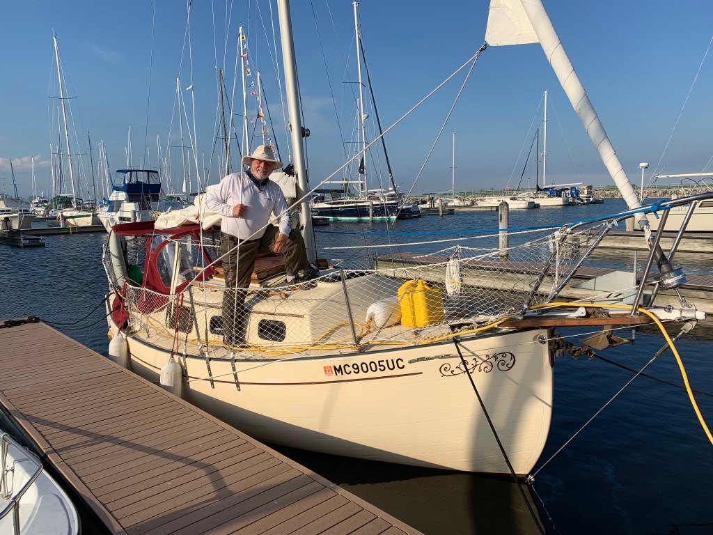
Thursday, July 25th (Day 80): I feel like a zombie. I was physically and mentally exhausted. Fortunately the weather was moderate in the upper 50’s, low 60’s with light to moderate winds out of the southeast and 2′ seas. I decided to power sail and was able to maintain 5 to 5 ½ mph. With the exception of almost running into a freighter, things were uneventful or more likely, missed as I fought to stay alert. Throughout the 42 mile trip to Beaver Island, I would nod off only to be awakened by something I apparently had missed.
It was 4 pm when I reached Beaver Island Marina in James Bay. Docked and fell asleep in excruciating back pain.
Friday, July 26th – Saturday, 27th (Days 81 & 82): My mind was in a vegetative state and my body ached. There was no motivation to leave my slip as I certainly wasn’t going to go out with over 30+ knot winds on Friday and Saturday. So I spent the next two days relaxing, sleeping, eating, gift shopping and even updating my blog.
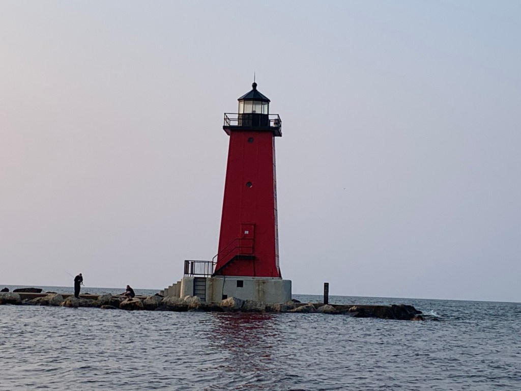
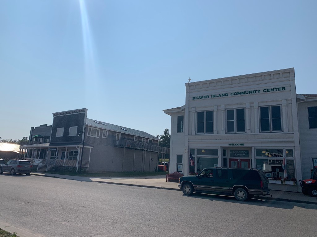
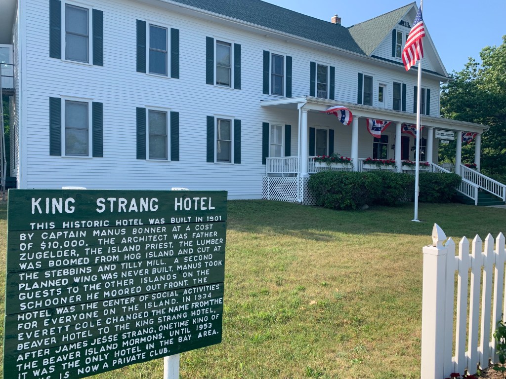
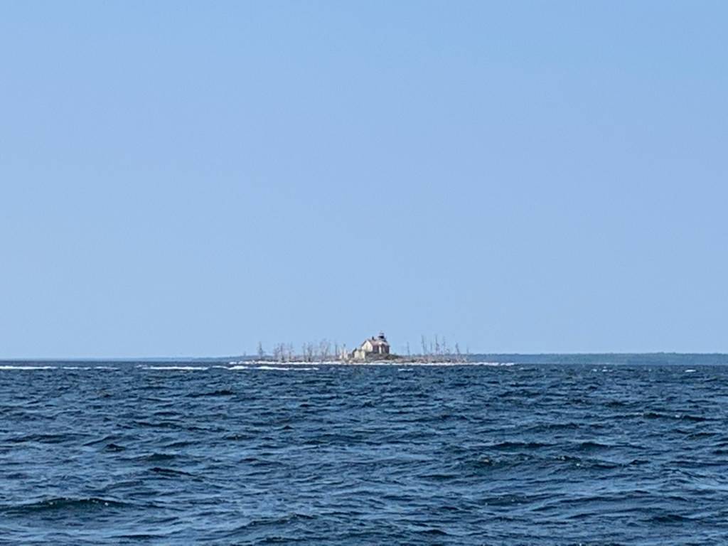
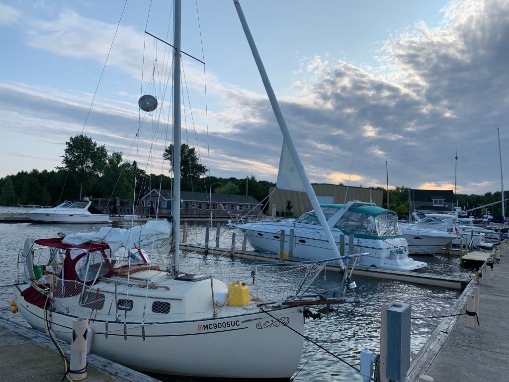
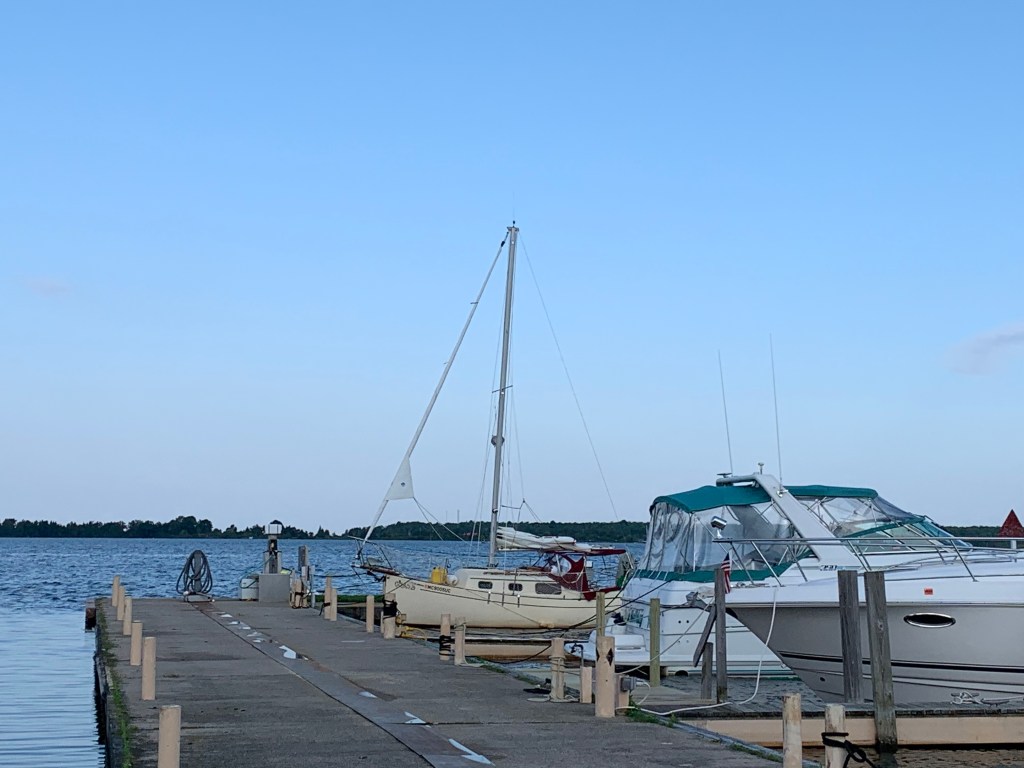
Last night I felt I anchored in no-mans’ water (land). Felt uneasy, exposed. I lifted anchor early without the assurance of a weather forecast (no internet/no I-phone connection). It was a long way to Beaver Island with no anchor points in-between. And, though very tired and sore I needed to get underway. Veered off as I nearly got run over. Battling to remain focused and alert.Beaver Island on the horizon. Yes!Central Michigan University Beaver Island research facility.Beaver Island Marine OfficeCentre of St. James, Beaver Island (the largest island on Lake Michigan).St. James Yacht ClubUninvited visitor. Water snakes were everywhere. Beaver Island had a King!
Wednesday, July 24th (Day 79): I’m OK when sailing, but when I’m docked or anchored, motivation is becoming a challenge. Fortunately, the forecast calls for winds coming from the south building to 15 kts. If the forecast holds, I look forward to an enjoyable sail with the wind on my back and should make good distance. However, I still will need to find a safe harbour to anchor as Manistique (Upper Peninsula) is nearly 70 miles to the north. Oh well, I’ve had two days of rest and should be able to find good anchoring. Portage Bay in the U.P. Garden Bay looks promising.
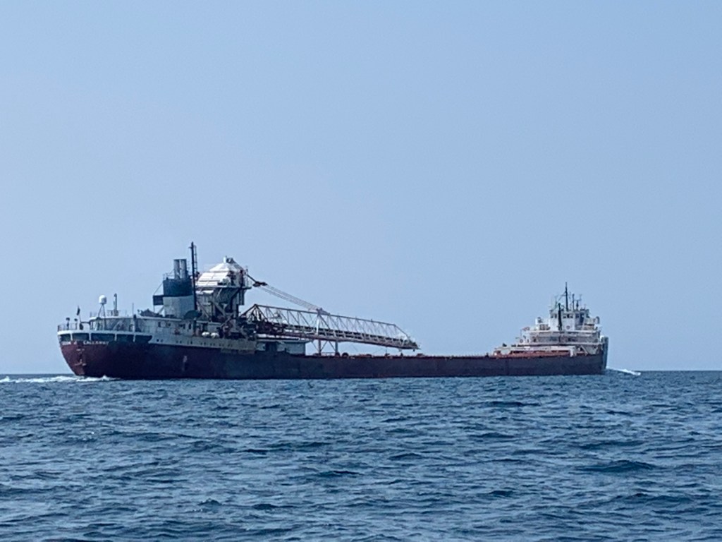
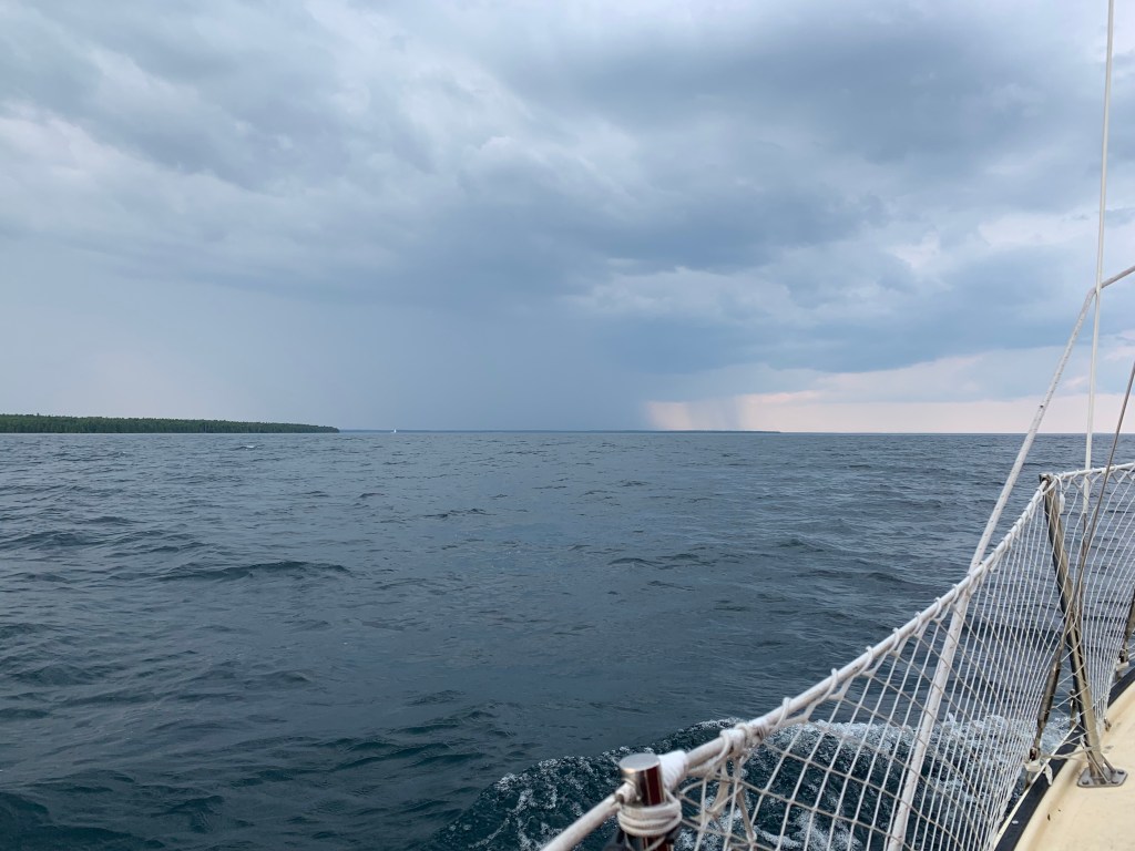
I left my slip early in the morning and headed across Detroit Harbour and into the narrow channel only to be pinched between one incoming and one outgoing channel! It was a bit too close for my liking. It took me about an hour and a half before making it through the channel and around Detroit Island. Under clear blue skies and the wind on my back, I set my auto-plot and sails before looking up for a weather update. Unbelievable. The forecast completely changed from two hours ago. Two severe thunderstorms were heading directly towards me from the north! I looked up and sure enough could see dark clouds on the horizon to the north west! Over the next half hour I carefully watched the direction and development of the storms. During that time, I saw another sailboat a couple of miles in front of me heading west for safe harbour between two islands. My initial reaction was to follow him but I felt uncomfortable with that strategy as the two storms were moving quickly. What if the two storms came together? It would be right over the safe harbour. I now could hear thunder and see lightning strikes as the winds clocked and were now coming from the direction of the oncoming storms. I tethered myself to the cockpit and took the helm changed my heading to the north east. I’m going to try to sail away from the weather. I now was on the edge of the fast moving storm but it was moving south west as I was sailing north east. I looked back to see the two storms indeed did combine and was right over the safe harboured sailboat. My instincts were right. Hope he will be alright. Half an hour later the weather had passed and I was fortunate to have only caught its edge. Will this weather ever end?
It was now late-afternoon as I approached Portage Bay. Unfortunately the winds again clocked and now were coming from the east south east. It was getting dusk all harbours thus far were exposed to the winds and offered no safe anchorage. After several unsuccessful attempts to anchor, I had no choice but sail into the night to Manistique.
N45.56.837, W86.14.945
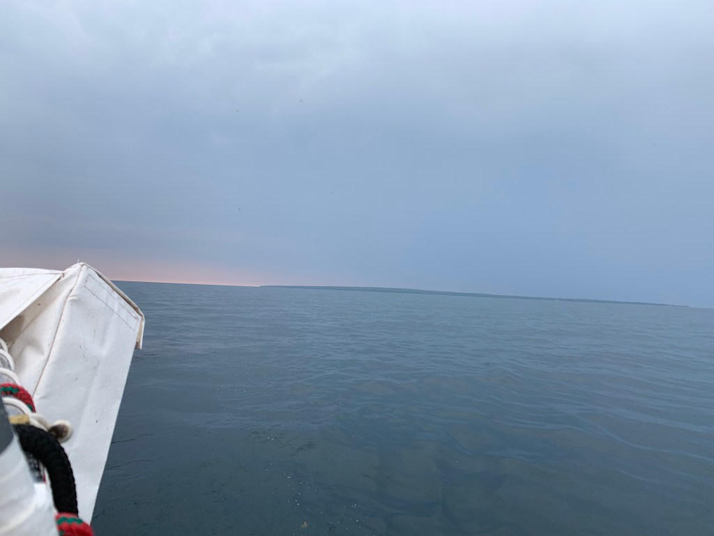
July 25th, (Day 80): At 4 am, nineteen hours after departing and 68 miles from Washington Isle, I went past the Manistique harbour breakwall, anchored and collapsed. Awakened at 6:15 am by the sounds of a freighter engine, I raised anchor and immediately proceeded east headed for Beaver Island.
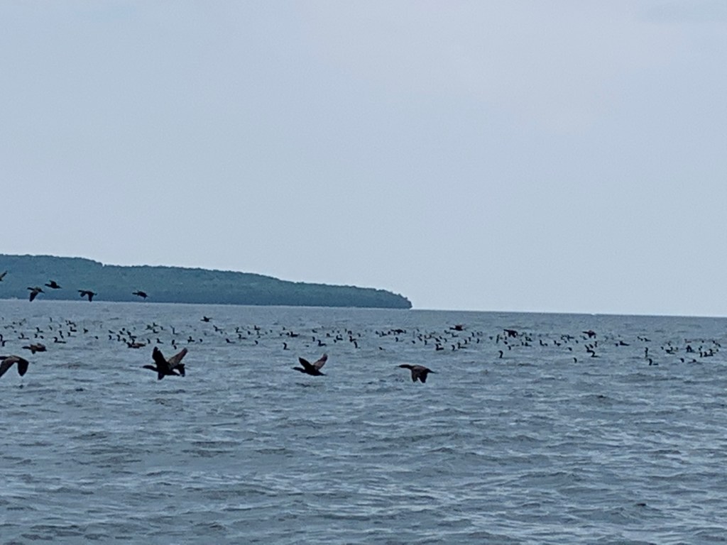
Lighthouse outside Detroit Harbour, Washington Island As I headed north enjoyed view of a beautiful schooner heading south west toward Washington Island.Sailing through a flock of Loons.Of course, another weather forecast error. Two thunderstorms suddenly appear from the north. Sailboat on horizon seeking safe harbour. Unfortunately, turned out to be the wrong strategy.Reefed main in advance of being hit by inclement weather.
Monday, July 22nd (Day 77): I awoke tired and sore to a cool (50’s) but otherwise clear morning. My decision to head for Chambers Island and anchor on its lee side for protection against the north winds had worked. I still wasn’t hungry and wanted to go back to sleep.
As I saw it, I had three or four options. I could stay anchored and rest a day. Or I could go northwest 17 to Cedar River (17 miles) or I could go north to Washington Isle (25 miles). I was not motivated to go anywhere and really wanted to just stay and rest. I checked the weather forecast hoping it would help me decide.
Currently the wind direction was unchanged from yesterday coming from the north at 18 knots gusting to 22. Later in the morning, the forecast called for the winds to die down to around 6 knots before switching and come from the south and southwest. Then in the late afternoon the winds were to switch back and come from the north again. I decided to make a ‘big’ assumption and evaluate the impact(s) for each option.
First, if I stayed anchored and the winds indeed shifted to the south, I would be completely exposed and would need to move. And if the wind shifted back to the north in the late afternoon as forecasted, I would need to lift anchor again (my aching back!) and move again. There would go my day of rest. Not a preferred option.
Second option, go northwest 17 miles to Cedar River. It would be a (fun) reach (but potentially physical) depending on the size and direction of the seas. It should also be a short three to three and a half hour sail assuming the winds didn’t shift before I reached my destination. Unfortunately, heading back for Cedar River would effectively add two days and I then would need 100% favourable weather in order not to jeopardize being on time to register for the Trans-Superior International Yacht Race. Not an option.
Third option, cut my circumnavigation of Green Bay short and head north 25 miles for Washington Isle. Washington Isl splits Green Bay and Lake Michigan and would allow me extra time to rest and recover. The drawback heading north was that it was going to be a beat (sailing into the wind and seas) which would mean a rocking and slower sail. Hopefully the winds would shift sooner rather than later.
I really wanted to rest but heading for Washington Island was the best option. I had anchored in the middle of the lee side of Chambers Island and decided to round the west end of the island and head north. My thoughts were that I would have the option to head west for Cedar River if the winds were too high and/or I found myself too exhausted to physically handle a beat run to Washington Isle. My strategy turned out to be a good one.
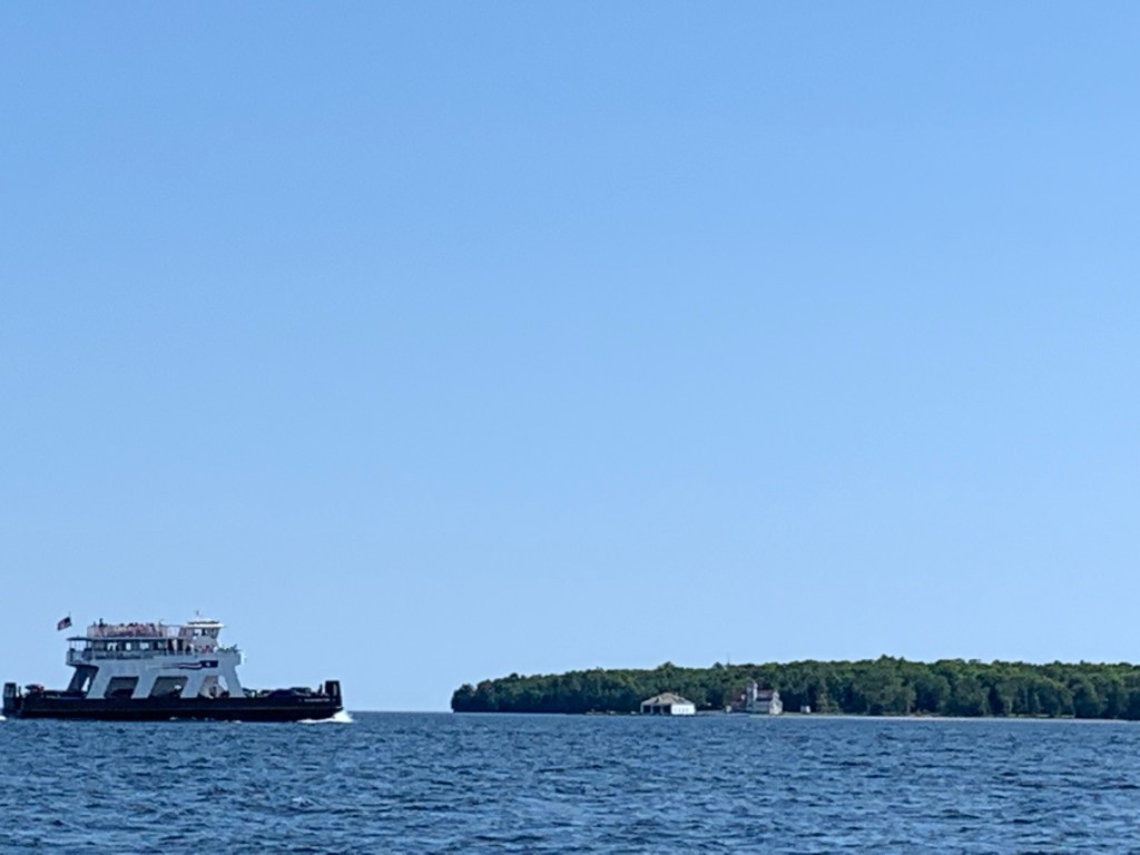
The winds lightened and shifted from the north to the south sooner than forecast. I found myself with blue skies and a light breeze on my back. Though slow it turned out to be a welcomed light air day. I finally arrived in the late afternoon. Washington Isles’ Detroit Harbour is very shallow and a difficult passage. And, given my unfamiliarity with the narrow channel entrance together with the ferry traffic, I found myself glued to my GPS chart plotter while slowly progressing toward Shipyard Island Marina.
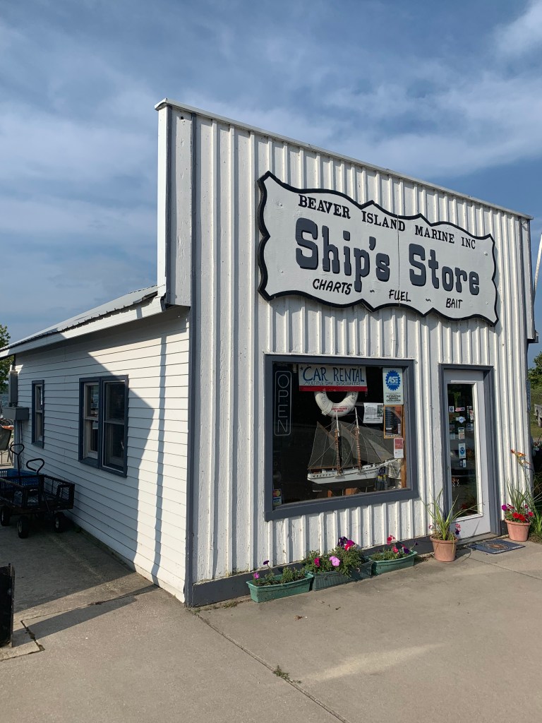
I had called in earlier to reserve a slip. I was given a slip location and (Kimberly) instructed me to hail on my VHF radio when approaching the marina for docking assistance. I hailed the marina about an 1/8 of a mile out and continued hailing with no reply. When I was about to enter into my slip I noticed someone on a pier put down her fishing rod and give me assistance in docking NTL. When NTL was secure, Kimberly picked up her fishing rod and VHF radio! (My first indication of the relaxed island atmosphere – good, just what I needed.)
After I showered, I made a peanut butter and jelly sandwich and retired early.
Tuesday, July 23rd, (Day 78): It was raining lightly when I awoke the next morning. It was a good time for me to assess my progress and status of my circumnavigation journey. I made oatmeal and coffee sat down, pulled up my cabin table, took out a pen and some paper and began reviewing my journey to the plan.
– Trip Assessment –
(Scale 0 – 5 – 10: 10 – at start, 5 – doable w/corrective action, 0 – change to plan required)
A – Plan & Schedule– (0): OK, my plan called for the circumnavigation of the five (5) Great Lakes to take from 95 to 125 days and cover between 3,500 and 4,500 nautical miles. I planned to be in St. Ignace the second week in July, which would give me three weeks to hit Georgian Bay and North Channel in advance of the Trans-Superior Race Sept. 2nd registration. The plan called for a month to circumnavigate Lake Superior and complete the last leg of Lake Huron. I planned to be home the end of August or the first week in September.
I had embarked May 7th and after 77 days I had gone 2,270 miles. I had completed circumnavigating Lakes Ontario and Erie, one leg of Lake Huron and was about to complete Lake Michigan in the next 4/5 days (or July 26/7th) – weather permitting.
I am 2 ½ weeks behind schedule! Not recoverable. If I do not lose any more time I can still complete circumnavigating all five Great Lakes but would need plan change and forgo sailing the North Channel and Georgian Bay. Five Great Lake(s) circumnavigations and Trans-Superior Int’l. Yacht Race completion remains doable.
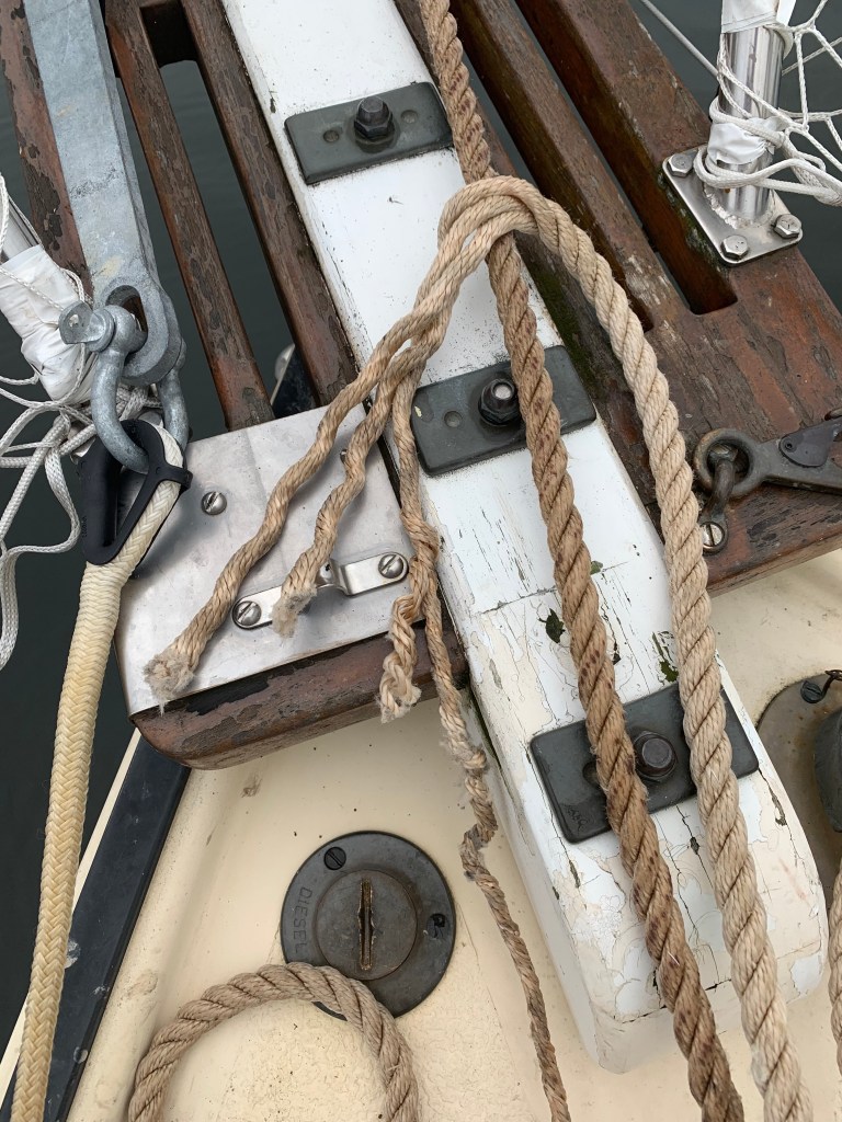
B – NTL & Equipment & Supplies – (5): NTL is solid though I have a growing concern with her ability to go to weather. NTL is a trade wind vessel not really suited to pointing into the wind. The wood plug is stuck in one of the two drain holes. I’ve been unable to get it out. My drill broke. I repaired the shredded anchor line and set up the back-up anchor for use if needed. The temporary repair to NTLs’ bimini is holding up thus far. The battery operated back-up bilge pump is deceased but the two handheld back-ups are working. My once a month re-supply resource has gone to Dallas so I have been on my own there.
C – Physical, Mental & Emotional Health – (5): The confinement on a 20′ sailboat together with the demands due to weather conditions are taxing my physical condition and I am in pain 24/7. But at my age that can be expected and I simply am dealing with it. I cannot overstate the emotional value from the encouragement and support I am receiving from so many. All I can say is its very appreciated. Keep it up. Its needed. Thank you. The adventure has shifted to a mission. Its no longer a Sunday afternoon walk in the park. Its not reached a level of being a chore but I’m more on a mission now. The one area I have a growing concern however, is the deterioration of my mental sharpness even when rested. I’m working on ways to address that but again the frequent storms are presenting a challenge. I am learning to trust my instincts. I have growing confidence in my abilities and feel self-assured. Time, rest and mental are the significant factors I need to manage.
O/A Assessment: This attempt is no longer a game. I’m learning everyday and I have a Germanic approach to it all.
I borrowed the marinas’ courtesy vehicle and purchased food supplies. The rest of the day was spent simply relaxing and reading a book.
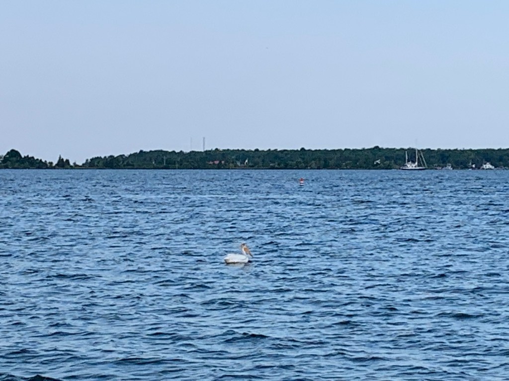
Taking west side of Chambers Island turned out to be a good decision. Northbound to Washington Island.Bald Eagle flying overhead under clear skies. Dove and caught a fish in its talons!Car ferry as I near Washington Island.Pelican as I enter Washington Island Passage in light winds.Never Too Late docked in Shipyard Island Marina.NTL neighbour arriving from Grand Haven. Dock still wet from another storm hit just after NTL tied-up.Taking in the peaceful and laid back atmosphere of the island.
Sunday, July 21st (Day 76) – I must have been exhausted because I slept through the second storm and awoke to a beautiful morning. The second storm was significantly less severe and the anchor held.
It was 9 am before I departed Sawyers’ Bay heading unto Green Bay. The forecast called for 6 to 9 knot winds from the north. It was going to be a beat but at least the winds would be moderate and no rain or storms were forecast.
I decided to go west across the Bay and sail north along the coast hoping to realize a shoreline buffer against the moderate north winds and seas. I called into Cedar River to reserve a slip for the night. Given the current winds, my GPS was projecting a doable 6 pm arrival. Though I had a good nights’ sleep last night, I was still exhausted and aching from the challenges of the previous three days of challenges. The three previous days were difficult with little sleep and what seemed endless physical and mental challenges. The weather presented fog, numerous T-storms and high winds (including a tornado with 90 +mph) and high seas. The accumulation of the challenges presented by the weather through the course of my journey were finally beginning to take a toll. In addition to my aching muscles, my skin was becoming raw from exposure and I was experiencing difficulty finding any position without being brought to tears from the constant pain in my lower back and disk. My age had caught up to me and my stamina was not what it was at the beginning of my journey. I could no longer go three or four or five days fighting Mother Nature without needing a few days of recovery. Cedar River offered the security of a slip where NTL would not be rocking and rolling in seas and where I would not have to be concerned about anchorage slipping or breaking. Where I could get out and walk even if painful to stretch my muscles and loosen my bones. But it was not to be.
Beginning in the early afternoon, the winds and seas began to slowly build. When the head winds slowly began to increase slowing my progress to a crawl. Winds now had doubled the forecast to well over 20 knots and the seas were now consistently over 7 to 9 feet! The current conditions resulted in a new projected arrival time of 2 am! I was fatigued both mentally and physically. And even if I was willing to overcome the physical challenges I began to question my mental ability to handle the helm for 10 more hours! A quick check confirmed there was no potential safe harbors before Cedar River. I took a 360 visual assessment and saw Chambers Island about six miles to the east of my position. If I could get to the lee side of the island I might be able to anchor in calm waters. I brought the helm hard left and power sailed east towards the island. Two hours later, I arrived, found anchor and crashed exhausted without eating.
Finally anchored on the lee side of Chambers Island, Green Bay. Past the point of the sun setting, the winds are blowing from the north at 25-30 knots and seas 7 to 9 feet high.
Saturday, July 20th (Day 75) – The storms ended and the skies were clearing as I progressed through the canal towards the town of Sturgeon Bay. As I slowly motored my way the canal widened. I sadly realized that had I been able to make it through the canal opening last night, I could have anchored in calmer waters and likely not had the anchor line failure. Oh well. Its in the past, enjoy the tranquility of the morning.
I came to the first of three draw bridges around 8:45 am. For the non-boater readers, there are one of two protocols to the opening of a drawbridge. Either it will automatically open at set intervals like every hour on the hour or, you need to hail the bridge attendant on a designated VHF channel requesting to open the drawbridge.
I hailed the first draw bridge asking the attendant the clearance height of the bridge. He informed me that the clearance was 40 feet. NTL spars height above the waterline was under 35′ so I went under the draw bridge without it needing to be opened.
At approximately 9:15 I came upon the second drawbridge. It was too low for me to go under and would need to be raised. I hailed the draw bridge attendant and was instructed to wait as the bridge will open on the hour. There was a light current so I motored to the side and waited. On the hour the bridge promptly began to open. As I tried to position NTL in front of the bridge I found myself repeatedly increasing the throttle revving it to over 3,000 rpms as I was making little progress. I slowly made my way under the bridge at approximately 2 mph. The water current must have increased so I thought. The third bridge was only a few thousand feet further and began to open at 9:30. Again I struggled against the current to make it through.
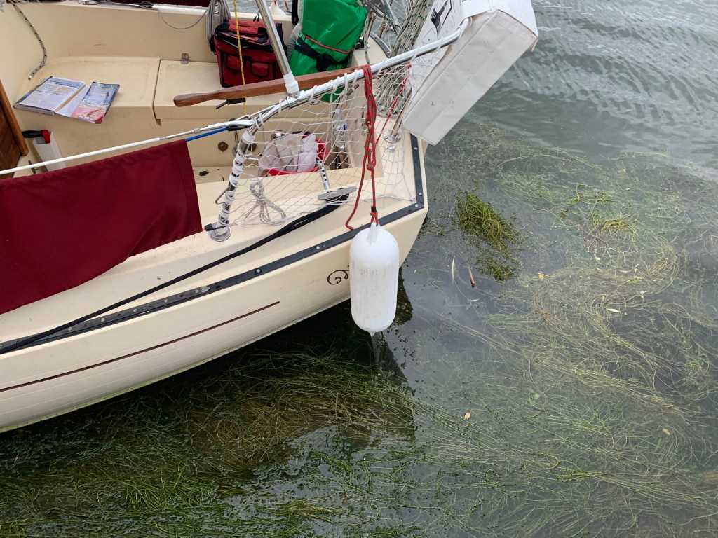
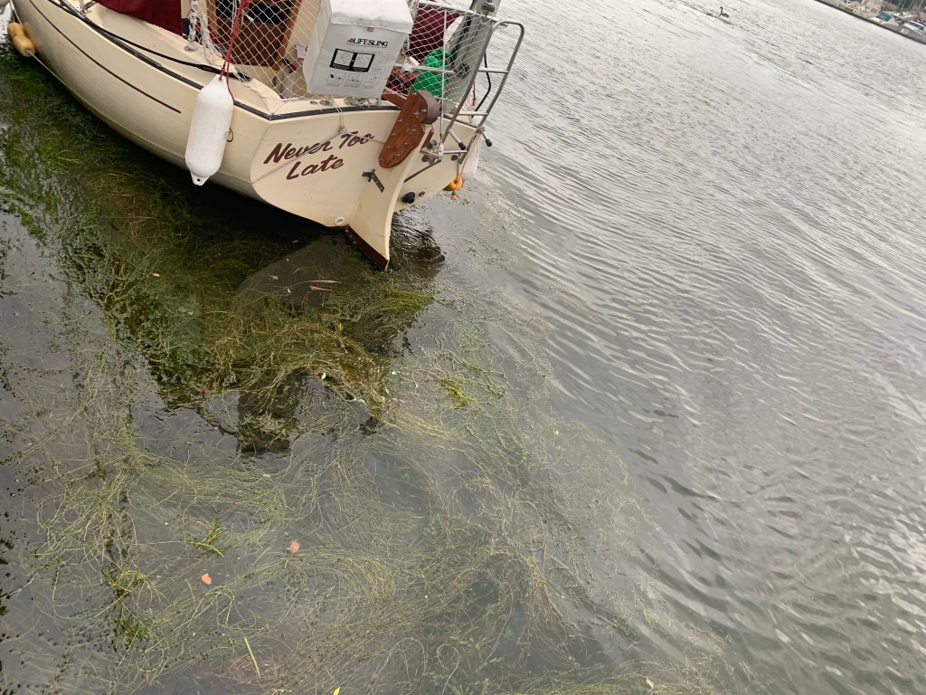
When I finally made it through, I put the engine in neutral and looked around. To my surprise NTL was surrounded by weeds. Slowly I progressed to were I could tie up and got out of the boat to get a better look. Not only was NTL surrounded but my prop was deeply tangled with the weeds as well! I took my dock pole and spent the next hour removing the weeds from NTL the best I could. I must have removed hundreds of pounds of weeds.
As I was approaching Green Bay (not the city, the water body), I checked my weather apps only to find severe thunderstorms scheduled to hit around 4 pm! Though tired, I was hoping to advance north on Green Bay but with severe weather on the way, I decided to safe harbor in Sawyer Harbor. I jury rigged my damaged anchor line and set anchor about 100 feet away from the waters edge against the western tree line for protection against the incoming storm and wind from the west. The storm hit as predicted and I went into my cabin again hoping one more time not to be struck by the lightning.
Suddenly in the middle of the building storm, NTL stopped shaking? Puzzled I looked out the cabin window and saw that my anchor was not holding and NTL was being pushed out into the bay. I quickly got out in the torrential rain, gale winds and lightning and secured a second anchor. NTL continued to drift as both anchors together were not holding! I did not want to crash against the rocks so I moved to the cockpit started the engine and gave it all she had. But to no avail as both anchors and fully revved engine could not prevent NTL from being swept against the bank in a little over 2 feet of water! Fortunately, the storm pushed NTL against thick bushes that kept us from running hard aground. And though the GPS showed that we were in 2 feet of water, it must have been mud and so NTL tilted against the bushes but didn’t go completely sideways. Well nothing more I could do, so I went below and waited it out. Only later I found out that the winds were clocked at OVER 90 MPH together with a tornado! No wonder NTLs anchors didn’t hold! I’m lucky to have survived!
When the storm had finally blown over, I went back on deck and raised both anchors. I threw the bow anchor out towards the lake then threw the second anchor towards the lake from the stern of the boat. I slowly pulled at each anchor until I was able to extract NTL from the bushes and into deeper water. I started the engine and powered back to the other side of the bay and re-anchored in only five feet of water some fifty feet from the shore tree line!
Never Too Late got entangled in seaweed while waiting for the third draw bridge to open in Sturgeon Channel.Estimate several hundred pound of seaweed entangled around entire vessel!No choice but to enter the water and remove seaweed from all around the Never Too Late.Speeding toward Sawyer Bay to safe harbour before storm hits.Surprise visitors before storm hit!NTL was blown across the Sawyer Bay against the shoreline bushes in a little over two feet of water!
Friday, July 19th (Day 74) – I arrived in Manitowoc in heavy fog and I left Manitowoc in heavy fog. It was 7:15 am in the morning when I left harbor on Friday. Even though storms were being forecast, I needed to be a bit more aggressive if I was to make Sault Saint Marie by August 1st. I was well rested and hoped to make Sturgeon Bay (65 miles).
As the fog dissipated and the breeze filled in, a ‘severe storm watch’ was announced by the USCG over VHF Channel 16. Numerous lightning strikes and high winds had been hitting Duluth all day and they were heading directly towards me.
The sailing was difficult and progress was slow in the rains, winds and seas from the passing storms. I sent a text to the Chairman of this years’ Trans-Superior International Yacht Race (who happens to reside in Duluth) requesting him to stop sending these storms my way.
It was after 11 pm when I realized I wasn’t going to make the 65 miles to Sturgeon Bay. For the past hour, I had been unable to find either a port or safe harbor. The building seas and winds became a growing concern as another storm was on its way. I finally reached the mouth of the Sturgeon Canal but was unable to maneuver NTL to enter in the heavy seas. Exhausted, I decided to get as close to shore, anchor and ride it out.
The water depth was 10 feet where I anchored. In my cabin, I put my electronics into the oven in case NTL was struck by lightning. I sat trying to keep my balance as NTL rocked up and down in the heavy seas. It was 3 am when I heard a loud bang. At first I thought my radar deflector had crashed unto the deck. I got out into the blowing storm started NTLs diesel and went to my bow with the intention of pulling up anchor as I knew these conditions were not sustainable.
I have a guardian angel. To my horror, the bang I heard was not my radar reflector, it was the breaking of 2 out of 3 weaves of my anchor line. I was about to lose my anchor! Fortunately the anchor line was damaged near the bow and I was barely able to reach down and eventually grasp the unbroken portion of the anchor line. It took all my strength to pull the anchor up. Once I secured the anchor to the boat, I powered up the diesel and eventually was able to safely maneuver into the canal.
As a side note, I found it a reflection of the conditions seeing 35′ plus charter fishing boats going out into the lake and turning around to come back into the canal.
Shredded anchor line Showing only one of three strands held during storm.Very, very fortunate anchor line held and I was able to take her up and re-attach line during the storm!
Tuesday, July 16th through Thursday, July 18th (Days 71 through 73) – Again the weather was not co-operating and I was in port for three days. However, my extended stay allowed me to get to learn a little about Manitowoc, meet some very friendly and sociable sailors, work a bit on my blog in the public library and purchase supplies.
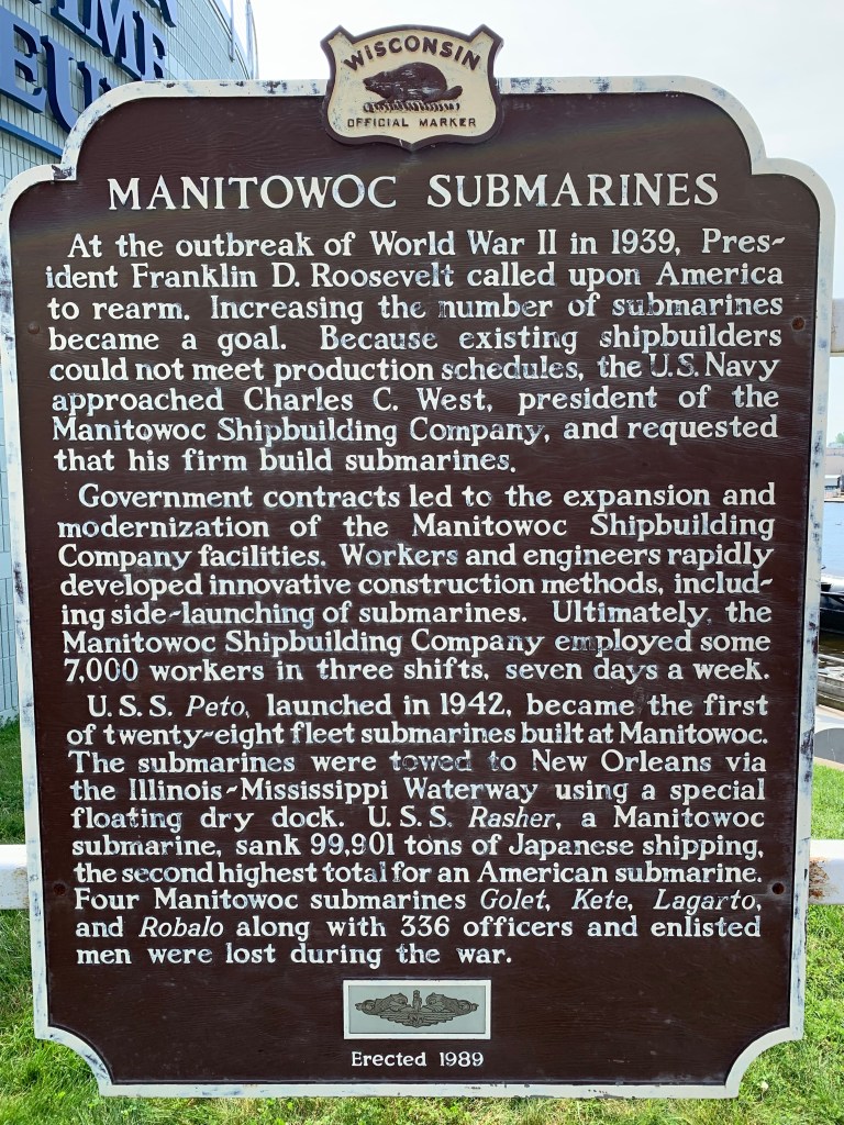
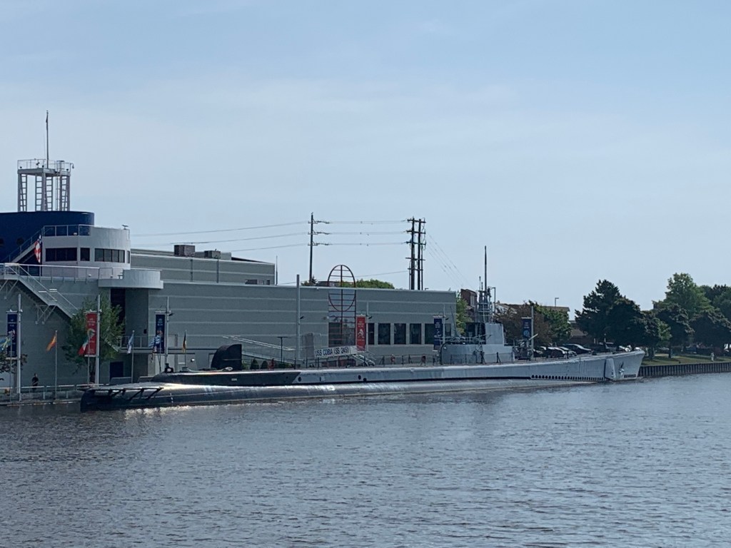
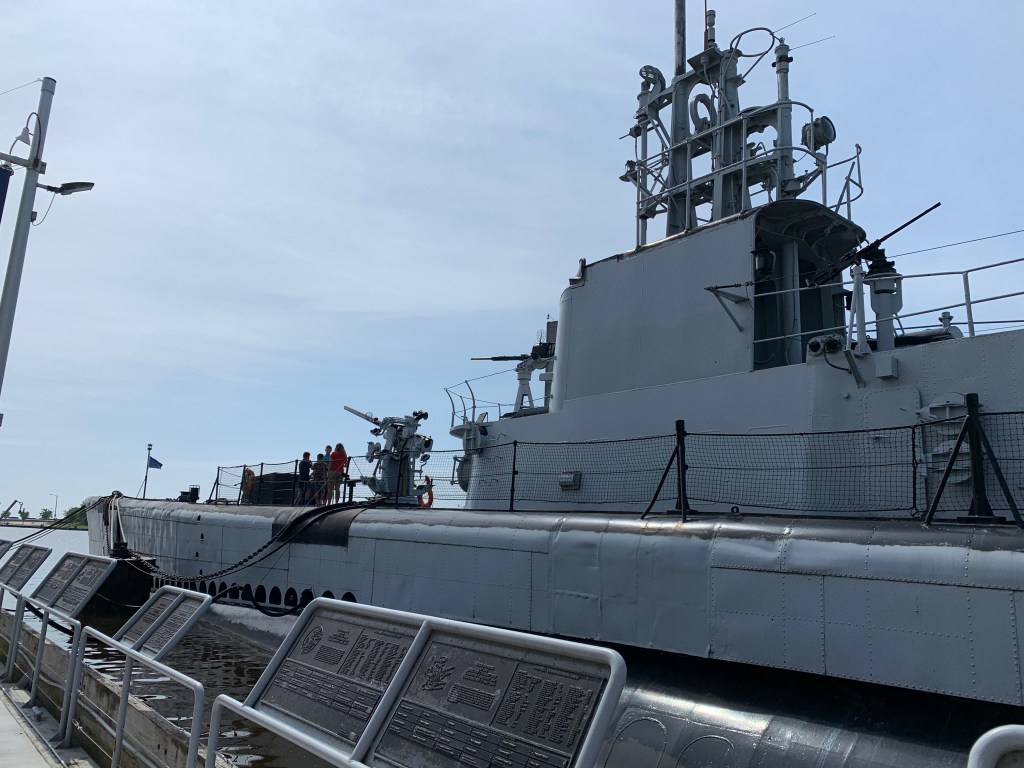
I learned that Manitowoc was a major ship building port. In fact, submarines were built here during WWII! I took pictures of one submarine brought back docked at a very impressive marine museum. Note: I promise to insert pictures as some point into my blog.
Now the fun begins (again)…..
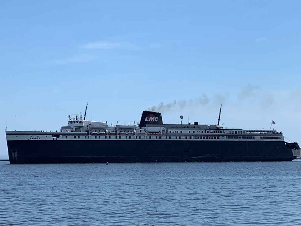
Left Port Washington sailing north while following strip of shoreline fog.Out in Lake Michigan enjoying great sailing in 20 mph winds out of the west. Noted storm clouds passing from the north going east.Entering thick fog along the coastline in a moderate breeze.Sailed blind in heavy fog with horn in hand and eyes focused on Garmin Chart Plotter. Finally fog began to lift as I entered Manitowoc Marina, Wisconsin.Picture forwarded to South Haven Tribune.Manitowoc, Wisconsin has a long ship building history including submarines during WWII. WWII submarine on display at Manitowoc Marine Museum.The Badger Ferry I was concerned about when entering the harbour in thick fog.A beautiful sailing vessel being re-furbished – one of several.Left Manitowoc in the same ‘fog’ conditions as when I arrived.
Sunday, July 14th & Monday, July 15th (Days 69 & 70) – I felt surprising good when I awoke the next morning – perhaps I was still euphoric. In any case, I forwarded my qualifier log to members of the GLSS for approval, lifted anchor and went to the fuel dock. Another good day was being forecast and I didn’t want to waist the opportunity. It was only 27 miles to Port Washington and with the weather moderate, it should be an easy day of sailing.
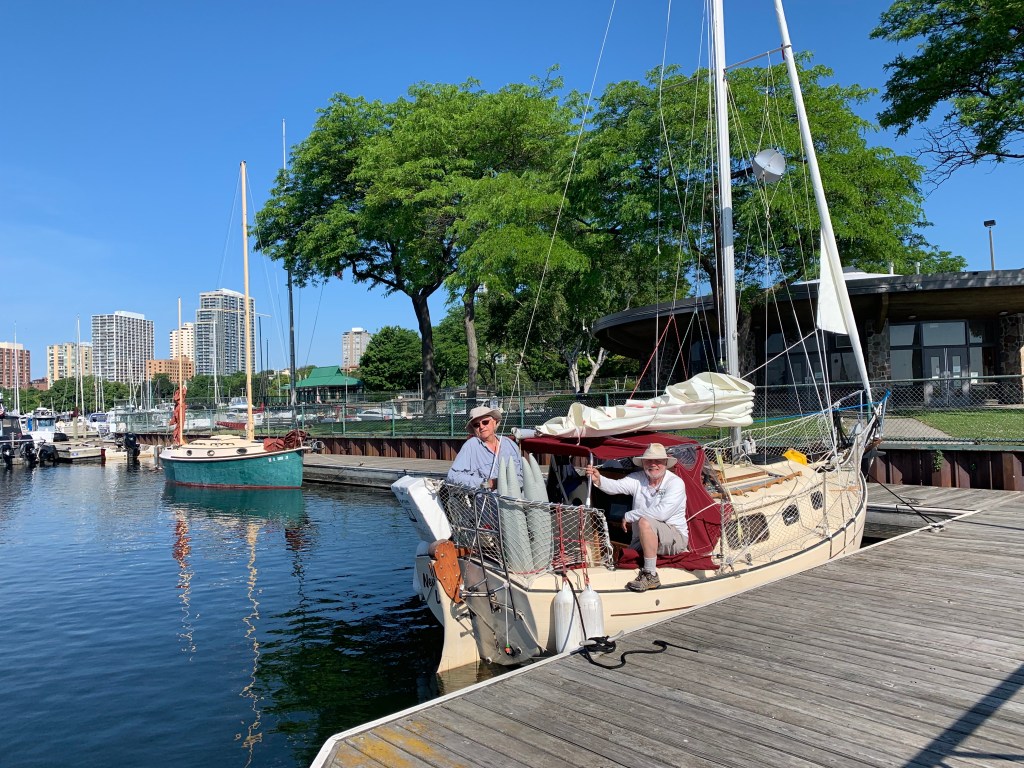
When I reached the fuel dock, I was met by the skipper (Jim) and crew (Anje) of Driftwood. This was the sailboat that I waived back to last night! We were chatting and decided to continue over coffee. It was a nice change and I enjoyed the experience. We took a few pictures and exchanged telephone numbers before departing. Jim and Anje heading south for Racine and I north for Port Washington.
The winds were light and from the south resulting in a very pleasant sail to Port Washington. I docked without incident, took a shower purchased a meal and retired early as I wanted to head out for Manitowoc the next morning.
A thunderstorm had awaken me during the night. Surprised, I looked up the weather forecast on my I-phone and found thunderstorms would be coming from the north for the entire day. I went back to sleep hoping the forecast would change by morning.
But it was not to be. I got up in another storm and my radar app confirmed a day of high winds and thunderstorms all along my route north. I was becoming concerned as another day would be lost.
I spent the morning doing laundry and working on NTL.
On to Manitowoc _
The weather cleared overnight and I set off early for Manitowoc in blue skies and a light breeze coming from the ESE (east south east). With the winds moderate and seas calm, it would be a relaxing day. But it projected to be a long day as Manitowoc was 56 miles away. Even though I left the harbor at 6:30 am, at my initial speed my arrival was projected to be around 8 pm – a long day.
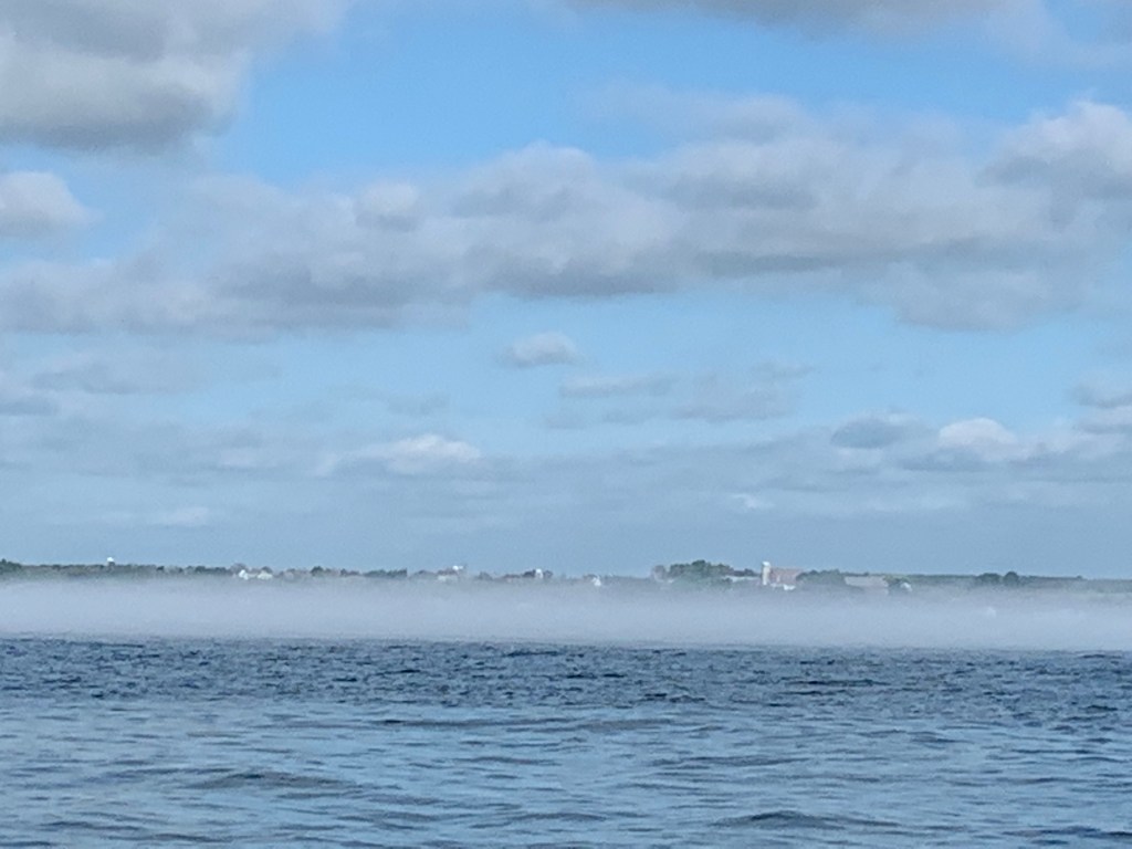
A low lying fog had developed along the coast shortly after my departure. I decided it was the hot air off the land evaporating the shoreline water. I headed out into the lake away from the heavy fog, fishermen and shoals.
The winds began to build over the course of the day which resulted in moving up my projected arrival time to 6:30 pm. Eventually the winds hit over 15 knots together with whitecap 3 to 5 foot seas coming from behind. I was sailing relaxed feeling content but finally decided to reef my mainsail as the winds and seas continued to grow. Unfortunately, I was a bit too late in my decision.
Generally when you reef you lower your main to reef or take down completely, you point into the wind. Often you can complete the task without changing course in moderate winds. Reefing in 15 plus knots and 5 foot swells – both coming from behind was causing the mainsail to jam. No matter how hard I tried I could not get the mainsail to lower. After numerous attempts, I turned NTL into the wind and when my main became limp, I was able to easily reef the sail.
It was now late afternoon and I was parallel to Manitowoc but since I had taken a course away from the shoreline, I found myself a little over 10 miles off shore. Normally on a clear day, one can easily see a shoreline 10-15 miles away. And even though the skies were clear, I hadn’t immediately noticed that the shoreline was not visible. The winds were good and with following seas, I was making hull speed even with a reefed mainsail.
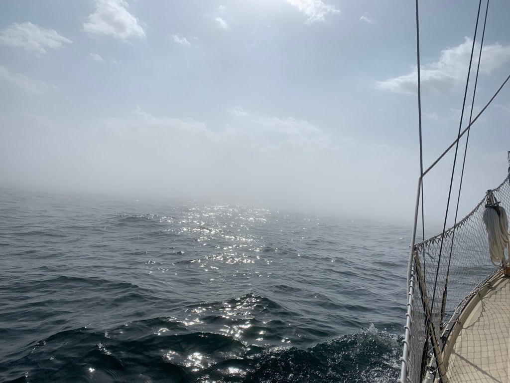
About an hour later with less than five miles to go, I looked at the horizon and was startled when I saw no land! I confirmed my heading, looked up again and completed a 360 degree scan of the horizon. No land in sight, just water. How can that be when there was not a cloud in the sky? Perhaps my auto-pilot had veered off course. No. Did I hit a magnetic field? Was my Garmin defective? What’s going on. I tapped into my I-phone and looked up my compass heading. Yup I’m heading in towards Manitowoc. It was another fifteen minutes before I finally became cognizant of what was going on.
As I squinted forward I finally could see what caused me not to be able to see land. It was the low fog that had developed in the morning and covered the entire coastline!
Relieved that I was not lost as I entered the heavy fog some four miles out, I quickly focused on my new challenge. Manitowoc was the home port for the ‘Badger’ car ferry and I was sailing blind! Its an uncomfortable feeling coming into a port you’ve never been to before while in a shipping lane and not being able to see beyond 30 feet!
I quickly took my sails down, started my diesel engine (noise), grabbed and tested my horn. With the horn placed next to me, I took over the helm and focused between my Garmin position and the fog in front of me – praying no one else was in the water.
Somehow, I was able to get to the marina just as the fog began to lift. Whew, boy was I glad to dock safely!
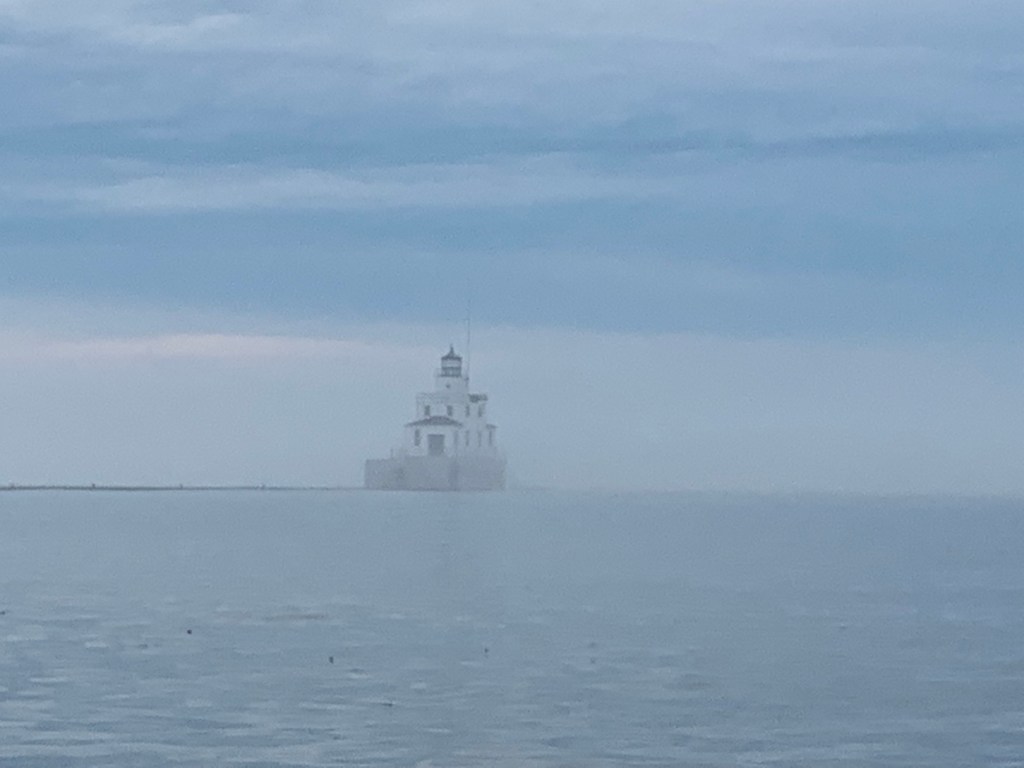
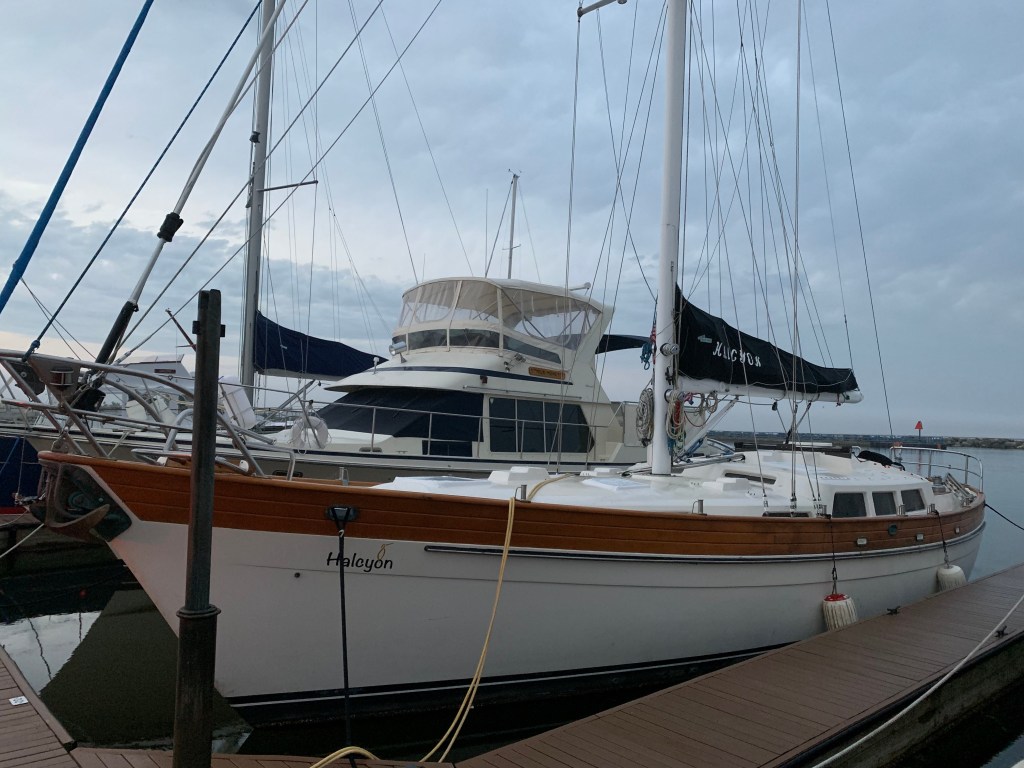
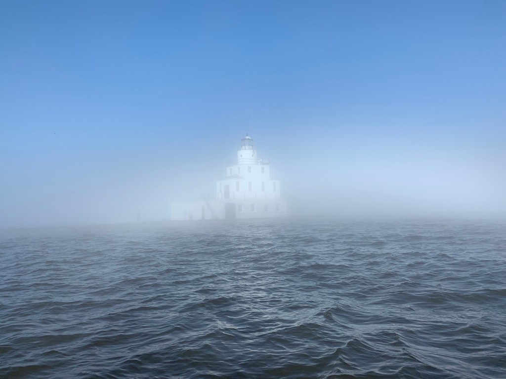
Milwaukee skyline at dusk. Never Too Late anchored alongside Driftwood vessel (right).Skipper Jim on me at fuel dock with Driftwood vessel in background.Port Washington Marina behind the break wall.Ghostly image of Manitowoc Light House – it suddenly appeared on starboard!
Entry #79: N43.02.110, W87.53.786 – Anchored in Milwaukee,Wisconsin
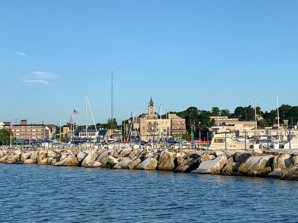
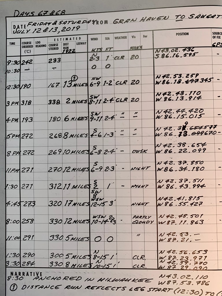
Friday, July 12th & Saturday, July 13th (Days 67 & 68) – I left the Grand Haven Marina relaxed and in great spirits. The weather forecasts were promising calling for NO STORMS and 6 to 8 knots winds and 1 to 2 foot seas (waves) from the north. I was heading south towards Holland and appreciated the winds on my back calling for a smooth sail. It is now or perhaps never to complete my 100 mile/24 hour Trans-Superior qualifier.
The forecasts called for moderate winds coming from the north shifting 180 degrees and come from the south in the early afternoon. The south winds were forecast to hold steady through the night. Should the forecast hold true, I felt comfortable with the following strategy _
As long as the winds were coming from the north, I would sail downwind along the coastline hopefully reaching Holland, then Saugatuck, then South Haven and so forth until the wind was forecast to shift and come from the south. At that point I would re-affirm the western weather patterns and immediately tack and sail on a reach as I would head for the Wisconsin coastline some 70 plus miles away.
As I left Grand Haven and got into open water, I immediately raised my sails, turned off my engine, marked my location into my Garmin GPS chart plotter and entered my starting co-ordinates into my logbook.
Unfortunately, the winds soon died down shortly after I began. After a half hour of little to know wind I decided to postpone my attempt until the wind picked up. (Due to the high PHRF rating of NTL, the GLSS would accept it taking me longer than 24 hrs to reach 100 miles. However, I didn’t want to push their exemption window.) Subsequently, I had to restarted my attempt twice before finally restarting for good when the winds came up at 12:30 in the afternoon from the same north direction.
I sailed for speed and distance with my direction serving as a reference and not a waypoint. The north winds were blowing at 9 to 11 knots for the next 2 1/2 hrs. The wind began to shift to the southwest shortly after 3 pm. I turned off my auto-pilot and took over the helm to take advantage of wind lifts from the shoreline. NTL was making good speed and I was enjoying the sail.
I had passed Holland and was about to pass Saugatuck when the wind shifted now coming from the south at 6 to 8 knots. With my wind apps on my I-phone I could see that there was a hole(no wind) developing at the bottom of Lake Michigan in the Chicago area. I then confirmed from my weather apps moderate winds coming from the south would continue through the night. Per plan, I immediately tacked heading west for Wisconsin.
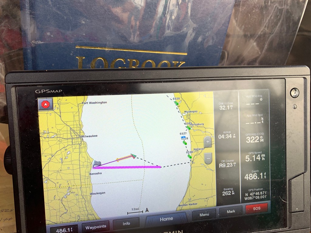
The 6 to 9 knot winds from the south lasted to 1:30 am before shifting coming from the west south west at 10 to a robust 15 knots. I continued to go for speed and change my course heading 40 degrees to maintain a reach tack. I was now heading further north towards Milwaukee, Wisconsin.
I was tired but turned off my auto-pilot around 8:00 am to more efficiently adapt to increasing fluctuations in the wind direction. At 11:00 am the next morning I suddenly hit a hole. Though I had been making great time – at times hitting 6 1/2 mph, I was still 25 miles short of reaching 100 miles. For the next three hours I battled the flies with my can of Raid.
When the wind finally filled-in, NTL had drifted 5 additional miles. Now had 20 miles remaining. I quickly made sail adjustments as the north winds continued to build to 15 knots. I again didn’t care about my direction, all I cared about was achieving the fastest speed and distance in the shortest amount of time. It happened that the direction I was headed led me towards Milwaukee.
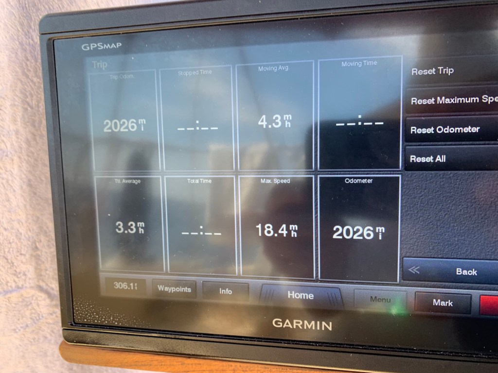
I started my attempt 1,927 miles into my journey. At 3:30 I read 2,027 miles on my GPS. I finally met my qualifier bogey and in only 28 hours!
I anchored in the Milwaukee, Wisconsin harbor at 8:30 pm that evening. I felt a sense of exhilaration and contentment during the five hour sail. It went without incident with one exception. As I motored towards my anchoring area I heard a hail from a crewmember on sailboat motoring out of the harbor, “That’s Never Too Late!” I smiled and waved as I continued on my way.
The Milwaukee harbor and skyline was beautiful as I fell asleep.
Day 68: 2048 miles, Lakes Erie & Ontario circumnavigation complete; Lake Huron one leg complete; Lake Michigan one leg complete proceeding north on the second leg.
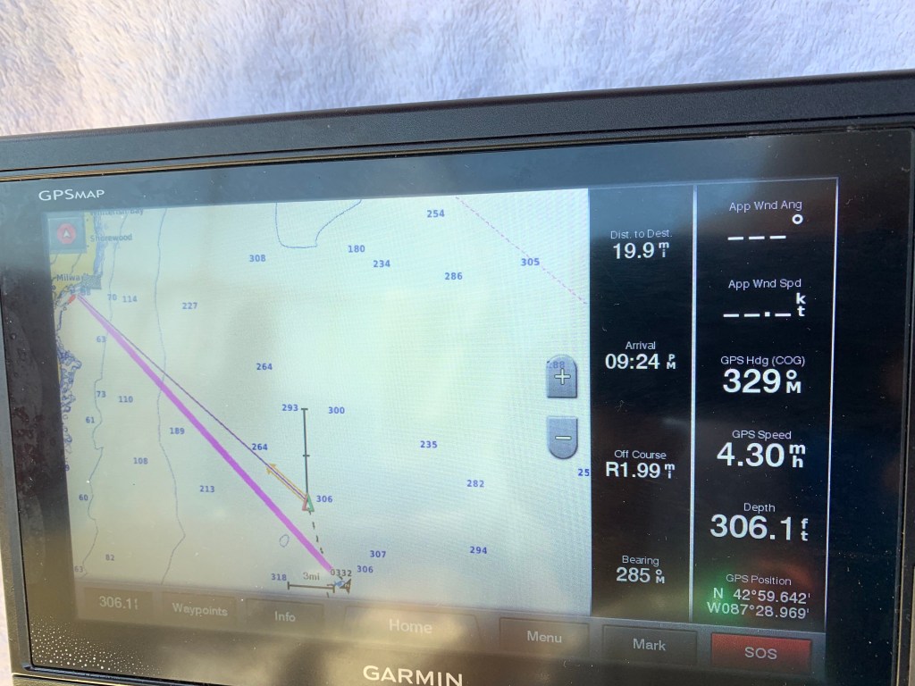
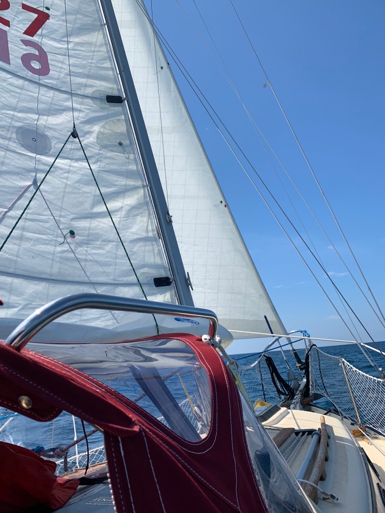
Hitting dusk while crossing Lake Michigan. I kept a watchful eye on the storm clouds and direction throughout the night. It turned out to be a peaceful and beautiful night sailing.Page 1 of 2: Trans-Superior overnight qualifier log entry. Note I left Grand Haven with my original plan to reach Saugatuck. Initially when I set sail, I wasn’t planning was to make a fourth attempt at qualifying for the Trans-Superior International Yacht Race. But I hate to leave a matter incomplete.Page 2 of 2: Unsurprisingly and contrary to forecast, sailing weather turned out promising and I decided to attempt (my fourth time) Trans-Superior overnight qualifier. I ended up crossing Lake Michigan and arrived in Milwaukee the next day.
I may be demonstrating paranoia by forwarding the pictures (below) as evidence following my fourth qualification effort. I could visualize the board members chuckling. I smiled too just thinking about it as I submitted my documentation. I also was grateful for the opportunity given me as well.
Entry #78: N43.04.033, W86.14.025 – Heads up this is my 4th attempt at updating my blog.
NOTE: I’m having a pickle of a time trying to post my updates. Each previous attempt somehow has disappeared when I attempt to publish my update(s). I’m stuck in Manitowoc, Wisconsin due to poor weather. That is not good as I’m running out of time to make the Trans-Superior Race start. The good, fortunately I found Manitowocs’ public library. Much to catch up on. (It may be a while before I will be able to publish another update. Please bear with my predicament).
Wednesday, July 10th & Thursday, July 11th (Days 65 & 66): I lifted anchor at Whitefish Lake and headed south beating into 3 to 5 foot waves and south winds at around 7 to 8 knots. The size of the seas were too big relative to the wind strength. I interpreted that to mean that both winds and waves would be building through the day. It turned out I was correct. As NTL rocked up and down into the growing seas, both my lower back and disc began to complain to Wilson who in turn did nothing to help me out. Ingrate. In addition, as the bow of NTL keep driving down and into the oncoming 5 to 6 footer, Poseidon kept demanding goggles and snorkel! I responded, keep me safe and I’ll consider it!
The day turned into a grind and was essentially uneventful with the following exception. Throughout the morning and afternoon I kept receiving texts of encouragement. I greatly appreciated the support as it served to lift my spirits. I began to analyze potential routes and weather forecasts for opportunities to make another qualifier attempt. Due to my itinerary and time, my opportunities to qualify were becoming limited before the Trans-Superior start of August 3rd. Additionally, I would need to consider the I decided it would be best to make my qualify sooner rather than later.
It was late afternoon when I finally made it to Grand Havens’ Municipal Marina late. I reserved a slip for two days with the intent to relax a day for physical and emotional recovery and have a second day to procure needed supplies. I took a well needed shower came back to the boat and spent the evening going over my planned and contingency routes. I felt comfortable with my plan, had dinner, took Aleve together with a heating pad for my aching back/disc and retired.
Thursday turned out to be a very busy day. I got up relatively early rested and feeling better both physically and emotionally. I made coffee and scheduled a 10:30 am transit to Meijers. I used the time in between to update my blog with entrees 77 & 78 – twice! Unfortunately, after completing composing my entries, attempts to save and to publish would fail and disappear! Finally after nearly three hours I completed a third entry and rather then lose it again, I took pictures of my narrative from my cellphone for future re-entry and publication. You are reading my saved entries as I attempt to catch up.
I found Grand Haven to be a very friendly, clean and family friendly community. I took advantage of their fantastic ‘guest’ transit services to pick-up supplies from Meijers. I simply called in and scheduled my pick-up from the marina. At the reserved time the van transit vehicle showed up, I paid my $1.50 fare and was transported to wherever I wished – in this case Meijers. When I completed shopping, I called in again and within 15 minutes I was picked up and brought back a hundred yards from my boat. The vehicles were clean, drivers very friendly and accommodating as I had unloaded my supplies.
As I organized my cabin with new supplies, people walking along the board walk as well as other boaters would stop and often come by inquiring about NTL and my destination(s). After hearing about my circumnavigation attempt, one individual brought his wife and introduced her to me saying this was the sailor I was talking about. She introduced herself to me and said that she had listened to my Sirius XM radio interview earlier in the week! Small world.
A few hours later, a Grand Haven Tribune reporter showed up, interviewed me and took pictures. (She texted me a few days later referencing the published article. The reporter did a beautiful story.)
Needless to say my Grand Haven stay was uplifting and I hope to return there sometime in the future.
OK pray this publishes in my blog!
Uneasy sleep while anchored during storms. Though tired left at sunrise. Taking in beautiful and moderately relaxing sail to Grand Haven.