Entry #80: N43.02.110, W87.53.786 Milwaukee; N43.23.299, W87.51.888 Washington; N44.05.766, W87.38.946 Manitowoc.
Sunday, July 14th & Monday, July 15th (Days 69 & 70) – I felt surprising good when I awoke the next morning – perhaps I was still euphoric. In any case, I forwarded my qualifier log to members of the GLSS for approval, lifted anchor and went to the fuel dock. Another good day was being forecast and I didn’t want to waist the opportunity. It was only 27 miles to Port Washington and with the weather moderate, it should be an easy day of sailing.
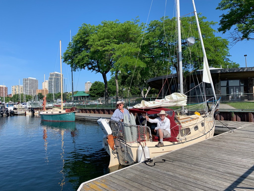
When I reached the fuel dock, I was met by the skipper (Jim) and crew (Anje) of Driftwood. This was the sailboat that I waived back to last night! We were chatting and decided to continue over coffee. It was a nice change and I enjoyed the experience. We took a few pictures and exchanged telephone numbers before departing. Jim and Anje heading south for Racine and I north for Port Washington.
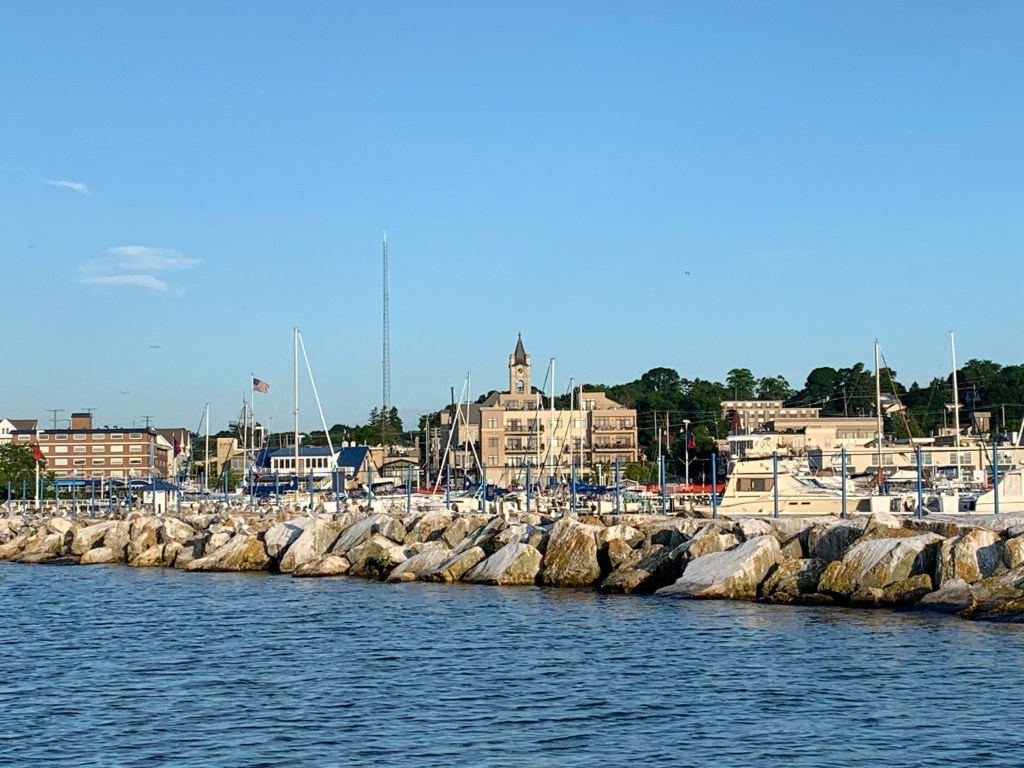
The winds were light and from the south resulting in a very pleasant sail to Port Washington. I docked without incident, took a shower purchased a meal and retired early as I wanted to head out for Manitowoc the next morning.
A thunderstorm had awaken me during the night. Surprised, I looked up the weather forecast on my I-phone and found thunderstorms would be coming from the north for the entire day. I went back to sleep hoping the forecast would change by morning.
But it was not to be. I got up in another storm and my radar app confirmed a day of high winds and thunderstorms all along my route north. I was becoming concerned as another day would be lost.
I spent the morning doing laundry and working on NTL.
On to Manitowoc _
The weather cleared overnight and I set off early for Manitowoc in blue skies and a light breeze coming from the ESE (east south east). With the winds moderate and seas calm, it would be a relaxing day. But it projected to be a long day as Manitowoc was 56 miles away. Even though I left the harbor at 6:30 am, at my initial speed my arrival was projected to be around 8 pm – a long day.
A low lying fog had developed along the coast shortly after my departure. I decided it was the hot air off the land evaporating the shoreline water. I headed out into the lake away from the heavy fog, fishermen and shoals.
The winds began to build over the course of the day which resulted in moving up my projected arrival time to 6:30 pm. Eventually the winds hit over 15 knots together with whitecap 3 to 5 foot seas coming from behind. I was sailing relaxed feeling content but finally decided to reef my mainsail as the winds and seas continued to grow. Unfortunately, I was a bit too late in my decision.
Generally when you reef you lower your main to reef or take down completely, you point into the wind. Often you can complete the task without changing course in moderate winds. Reefing in 15 plus knots and 5 foot swells – both coming from behind was causing the mainsail to jam. No matter how hard I tried I could not get the mainsail to lower. After numerous attempts, I turned NTL into the wind and when my main became limp, I was able to easily reef the sail.
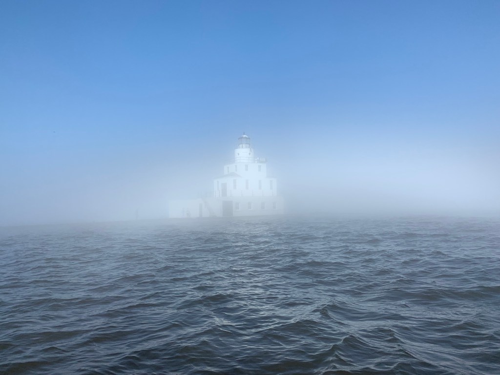
It was now late afternoon and I was parallel to Manitowoc but since I had taken a course away from the shoreline, I found myself a little over 10 miles off shore. Normally on a clear day, one can easily see a shoreline 10-15 miles away. And even though the skies were clear, I hadn’t immediately noticed that the shoreline was not visible. The winds were good and with following seas, I was making hull speed even with a reefed mainsail.
About an hour later with less than five miles to go, I looked at the horizon and was startled when I saw no land! I confirmed my heading, looked up again and completed a 360 degree scan of the horizon. No land in sight, just water. How can that be when there was not a cloud in the sky? Perhaps my auto-pilot had veered off course. No. Did I hit a magnetic field? Was my Garmin defective? What’s going on. I tapped into my I-phone and looked up my compass heading. Yup I’m heading in towards Manitowoc. It was another fifteen minutes before I finally became cognizant of what was going on.
As I squinted forward I finally could see what caused me not to be able to see land. It was the low fog that had developed in the morning and covered the entire coastline!
Relieved that I was not lost as I entered the heavy fog some four miles out, I quickly focused on my new challenge. Manitowoc was the home port for the ‘Badger’ car ferry and I was sailing blind! Its an uncomfortable feeling coming into a port you’ve never been to before while in a shipping lane and not being able to see beyond 30 feet!
I quickly took my sails down, started my diesel engine (noise), grabbed and tested my horn. With the horn placed next to me, I took over the helm and focused between my Garmin position and the fog in front of me – praying no one else was in the water.
Somehow, I was able to get to the marina just as the fog began to lift. Whew, boy was I glad to dock safely!